Search U.S. business registrations and federal trademark records
Maryland · Along the ChesapeakeLife along the Chesapeake.
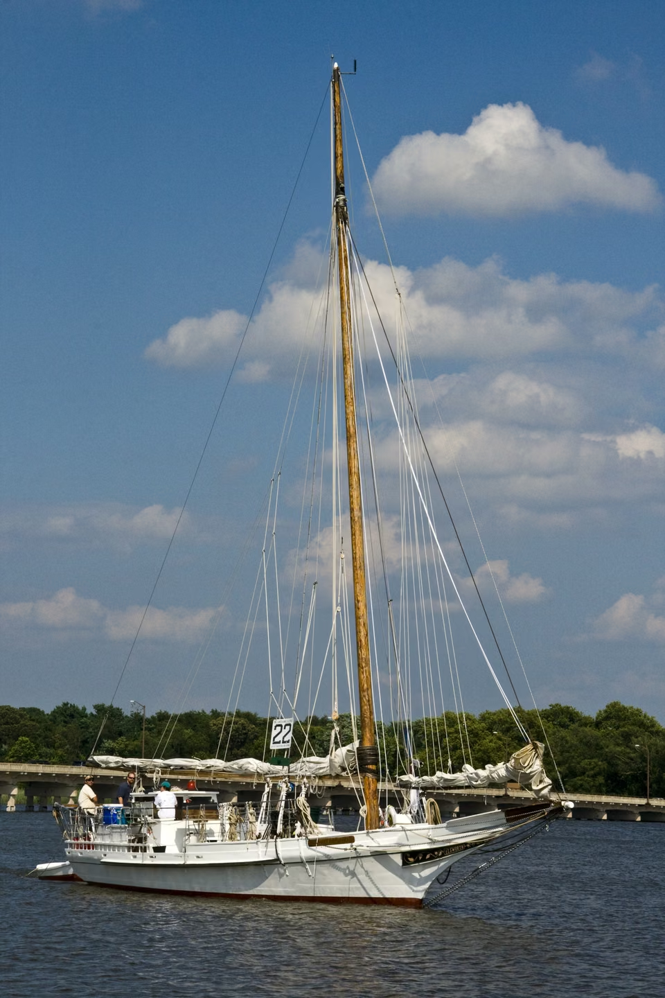
Chestertown · The traditional sailing vessel Elsworth
Western shore
Ports and cities. Science and distant horizons.
Eastern shore
Wetlands and towns. Tides and tables.
Maryland
One bay, many ways of life.
The water links ports, islands, and cities. Inland lie old mountain canals, routes toward freedom, and laboratories looking into the universe.
Understand the bay, then explore its shores.
Water is part of every day.
State capitalAnnapolis
Population · 2025 estimate6,265,347 people
Chesapeake Bay gives Maryland distinct landscapes. The Eastern Shore’s lowlands, farms and tidal rivers follow a different rhythm from the western shore cities of Baltimore and Annapolis.
Fishing, shipping, and cruise boats share the waters with coastal communities, each facing different issues: the need to maintain channels, the reliance on the ecosystem by the fishing industry, and concerns about traffic, housing, and daily services for residents. Bringing these relationships together ensures that the bay is more than just a scenic view.
Traditional sailing boats were involved in oyster fishing. The maritime museum preserves the boats, tools, and labor records to allow today's people to recognize the connection between shipbuilding, navigation, and water-based livelihoods.
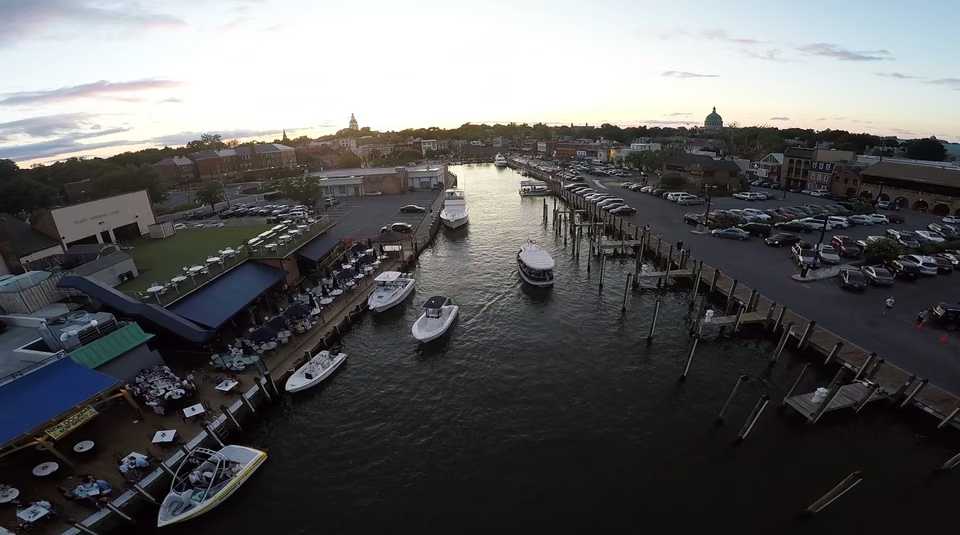
Annapolis · City Dock and harbor
A state capital at the water’s edge.
Annapolis replaced St. Mary’s City as the seat of colonial government in the 1690s. Today, the state capital, Naval Academy and harbor life overlap in neighboring streets, bringing public affairs and daily life close together.
The Continental Congress met here in 1783–1784, and the Treaty of Paris was ratified here in 1784. The old town can be understood through its buildings and docks, as well as through the events that unfolded among them.
Bay ecology · Winter survey, 2026
More blue crabs, but concern for adult females remains.
349million crabsThe total blue crab population estimate is estimated to be 46% higher than the previous year.
228million crabsBaby crabs are estimated to have increased by 121% compared to last year.
81million crabsAdult female crabs are estimated to be 25% fewer than the previous year.
The increases in the total population and juvenile crabs are encouraging. Adult females, however, remain below the management target, so these different trends should not be described as a complete recovery. Researchers continue to monitor breeding populations and juvenile recruitment.
This is a bay-wide estimate conducted by Maryland and Virginia cooperation, not the fishing quota for Maryland alone, nor does it equate to the allowable catch. Population surveys, fishery catches, and table supplies describe different things.
Maryland's Natural Resources Department released this on May 18, 2026; the survey covered approximately 1,500 points in the bay. Adult female crabs were found above the management threshold but below the target level.
Smith Island is accessible by water to the home.
Island life has its own connections—and its own flavors.
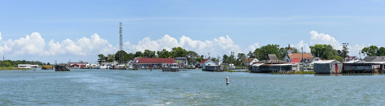
Smith Island · Ewell harbor, 2021
A wharf is scenery and essential infrastructure.
Channels, waterfront buildings, and moored boats reveal how closely island communities depend on the water. For residents, a wharf is more than a visitor’s photograph: it connects journeys, supplies, and work.
The Chesapeake Bay's food traditions are inseparable from livelihoods on the water. Crab and oyster dishes vary in preparation, season, and origin; a local dish name alone does not establish that every ingredient was caught nearby.
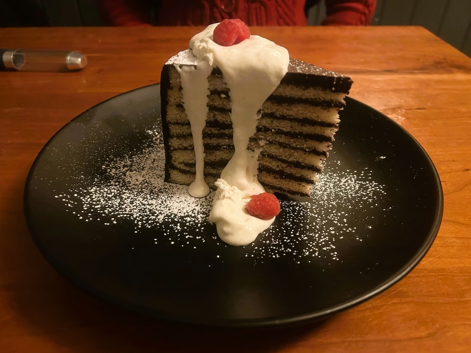
Smith Island cake · Thin layers and chocolate frosting
Smith Island Cakes are famous for their multi-layered cakes with chocolate frosting. The number of layers varies according to family recipes, adding one layer upon another, which defines their distinctive appearance.
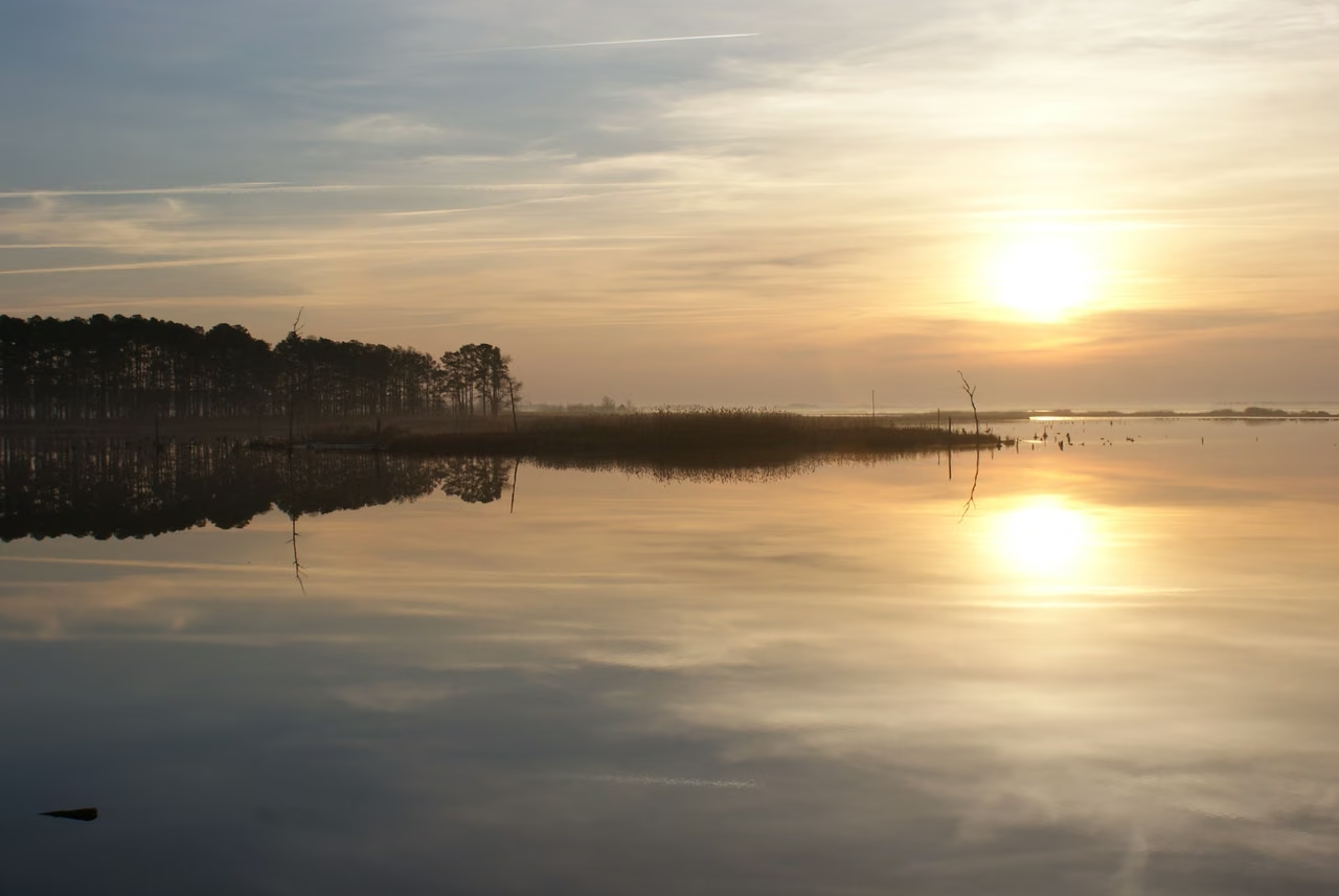
Blackwater National Wildlife Refuge · Rivers and Eastern Coastal Wetlands
Dorchester County and the Eastern Shore
Quiet shores along a difficult road to freedom.
Place the people back in the landscape.
Harriet Tubman was enslaved on the eastern shore of Maryland and later helped others to gain their freedom. The familiar fields, woods, rivers, and wetlands of her early life environment are important to understanding her past experiences.
National Historic Parks preserve and tell not just about one building, but about relationships between people and places. Today, when viewing the East Coast scenery, one should also see the people who labored, were oppressed, and helped each other here.
The Underground Railroad was no railroad.
This name refers to the network of people and routes that helped enslaved individuals escape to freedom. It required courage, local knowledge, and mutual trust; many people's involvement cannot be summed up by a neat route.
The natural landscape of the protected area shares a narrative with the historical park, but the photographs do not designate any specific escape route. Preserving the landscape's authenticity also means clearly stating what can be known.
Baltimore · Port and Trade
On the water, a different scale of movement.
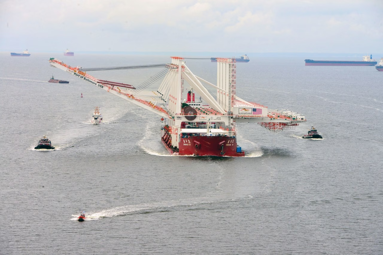
Port of Baltimore · New ship-to-shore cranes arriving in 2021, archival photograph
2025 total port cargo volume50 million tons
Public and private terminals combined
Vehicles, machinery, and containers take different paths.
In 2025, Baltimore Harbor handled goods valued at approximately $65.6 billion. It processed 728,225 vehicles and light trucks. Public terminals handled agricultural and construction equipment roll-on/roll-off cargo weighing 887,513 tons.
These categories correspond to different loading, yarding, inspection, and transportation arrangements. Companies serving port customers should first clarify the goods and operational stages before comparing facilities, partners, and delivery conditions.
The public wharf generally handled about 11,100,000 tons of cargo, which is included in the total port volume and cannot be added again. The value of the goods is also not part of the port's revenue from operations.
In 2025, container volume was approximately 1,100,000 TEUs. A TEU stands for Twenty-foot Equivalent Unit, which measures capacity based on a twenty-foot container, not the actual number of containers on site.
Maryland government released the 2025 Port Statistics on March 24, 2026. The original value of the total cargo was 49,983,622 tons. A photo shows the quay crane arriving in 2021, which differs from the statistical year.
From waterfront districts to fortress guarding harbors.
A city’s memories along its waterfronts.
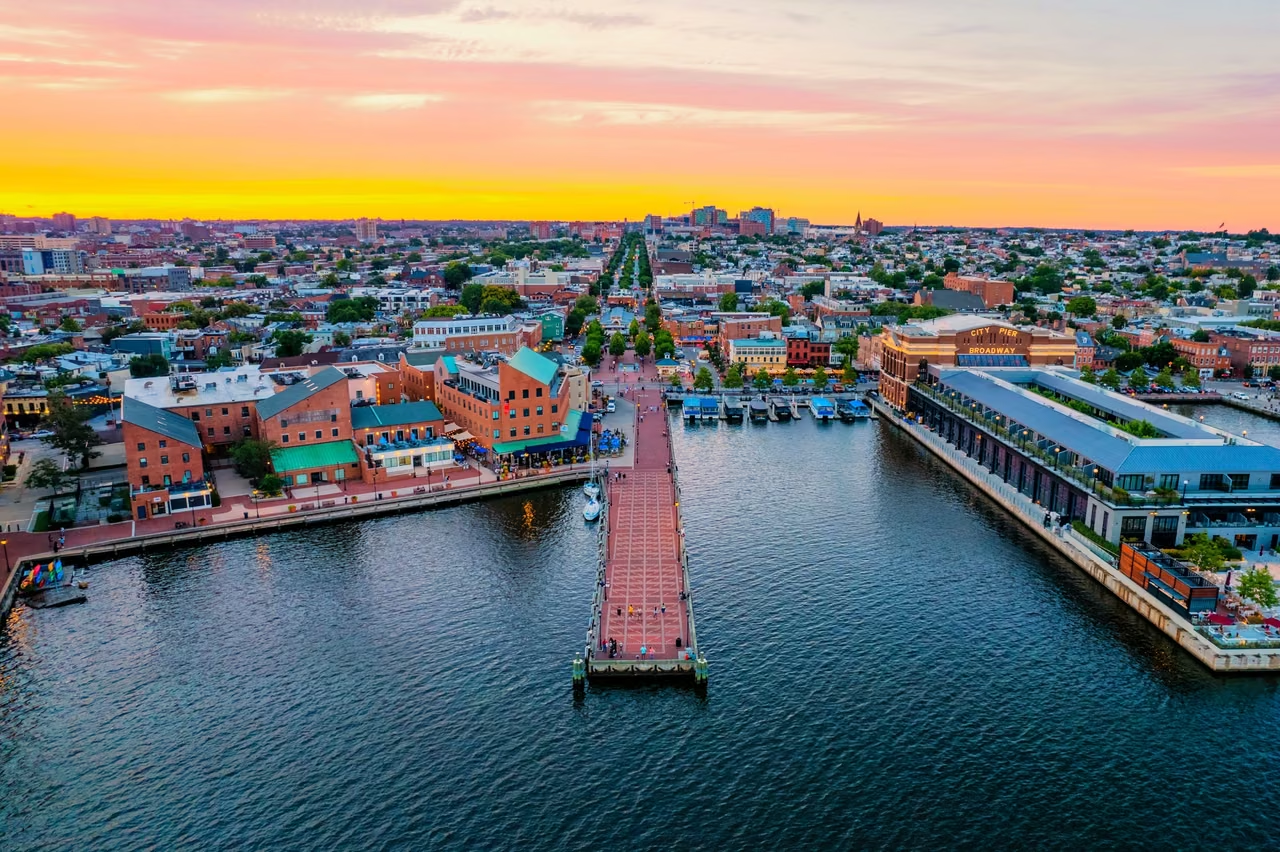
Baltimore · Fells Point from above, 2022
Neighborhoods are more than a port’s backdrop.
Waterfront streets, rows of houses, and commercial spaces form the fabric of Fells Point. Visitors, residents, and businesses share the neighborhood, using its public spaces in different ways.
Observe local businesses and start by seeing which groups they serve: residents, tourists, or customers from other areas. A city's overall reputation shouldn't overshadow the specific needs of a particular street.
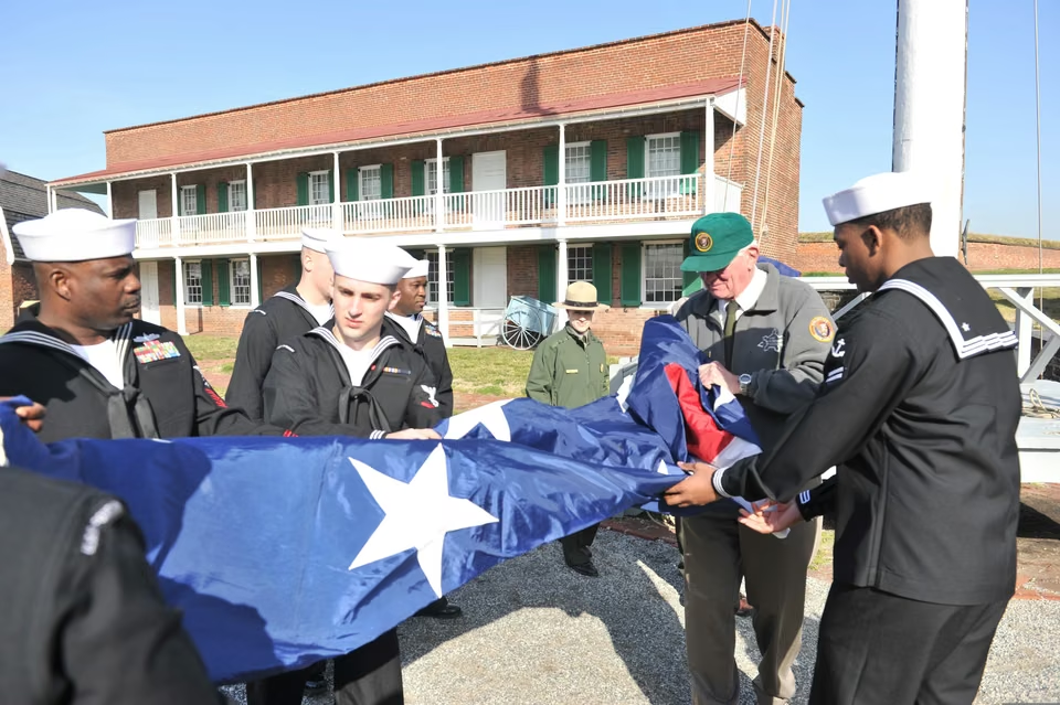
Fort McHenry · Sailors unfurl a flag at a 2012 commemoration
A fort and a national anthem.
Fort McHenry resisted British attack in the 1814 Battle of Baltimore. Those events inspired the words that later became the U.S. national anthem. The fort is both a military site and a place to explore public memory.
The exhibits on national parks also focus on different individuals associated with fortresses. Beyond the architecture, flags, and narratives of war, human experiences make history more concrete.
Greenbelt · Goddard Space Flight Center
Some distant journeys begin with precise work on Earth.
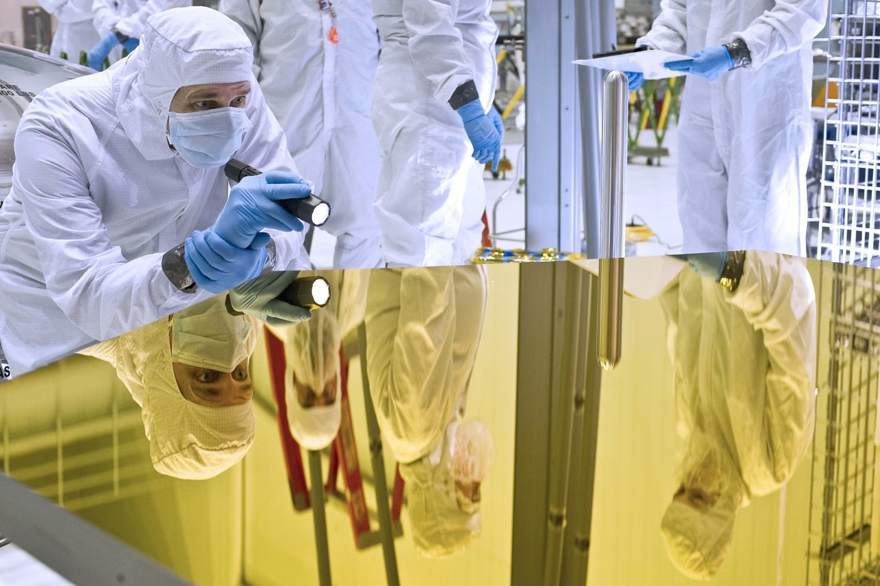
Webb Telescope Mirror Arrives at Goddard – History of Development Imagery
Looking into space. Studying our own planet.
Goddard is located in Greenbelt, Maryland and is an important scientific and engineering center for NASA. Researchers, engineers, and technical teams collaborate on missions to convert scientific questions into instruments, tests, and long-term observations.
The Webb telescope's development demonstrates this kind of collaboration. Components and lenses were manufactured and tested in different locations before forming a system capable of working in space; Goddard played an important role in the assembly and testing.
A photograph from the development process.
The mirror’s arrival in the photograph predates the telescope’s launch. Primary-mirror assembly was completed in 2016, and the telescope launched in 2021. The image records the work of ground-based development.
The value of scientific facilities also includes technical expertise, collaborative talent, and specialized division of labor. Specific capabilities are needed for supply, experimental support, and engineering services, and one cannot assume business opportunities based solely on proximity to a single institution.
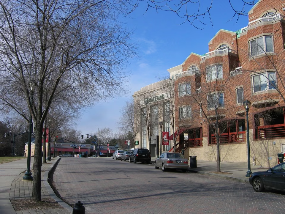
Rockville Town Center public space
City Living & Work · Daily Needs Matter Too
Beyond research, everyday life fills the streets.
Rockville, among other commutes surrounding Washington, has a lifestyle linked to suburban employment but also its own dining, stores, and public spaces. People of different ages, families, and professions share these places.
When assessing local services, the commute direction, arrival time, walkability environment, and surrounding residents are more relevant to the actual operation than the vague term "research advantage." The professional institutions involved in these services and the residents' daily consumption are interconnected yet distinct markets.
2,806,200In August 2026, non-agricultural jobs.
Down 8,200 jobs from July; manufacturing employed about 110,600. Statewide changes do not describe every city or industry.
U.S. Bureau of Labor Statistics, released September 18, 2026; seasonally adjusted, with preliminary August figures.
Registration, property reporting, and operating premises.
Maryland requires businesses to schedule annual reports; the typical deadline for 2026 is April 15th, which can be extended as per regulations. Whether the property tax returns apply depends on the assets and specific regulations; annual reports cannot be conflated with all tax matters.
Businesses with fixed establishments such as restaurants, retail, warehousing, or industries must consider local permits, venue usage, employment, and industry requirements separately. Starting a business is the initial step, and the subsequent permits needed are determined by the actual operational arrangements.
Maryland Assessment and Tax Department guidelines for registration and annual maintenance are based on 2026 business filing materials; queries can be made on this site.
Industries & establishments · 2023
The work that keeps communities running.
Healthcare, retail, and professional services industries cater to different local demands. Ports and research are notable features, but they cannot replace an understanding of the entire employment structure.
The state recorded 142,967 employer establishments and 2,468,367 paid employees. A single company may operate several stores, offices, or factories, so establishments are not a count of registered companies.
Health care & social assistance403,945 people
Professional & technical services301,509 people
Retail trade289,469 people
Administrative & support services256,840 people
Accommodation & food services241,483 people
U.S. Census Bureau, 2023 County Business Patterns. The series primarily covers private, nonfarm establishments with paid employees. Employment is measured for the pay period that includes March 12. The 2023 release was the latest in this series available when checked; it is not a measure of current monthly employment.
Western · Cumberland
From the bay, follow another waterway into the mountains.
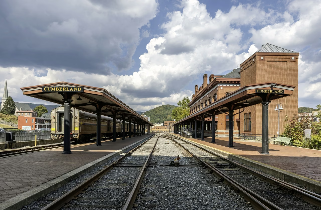
Cumberland & Western Maryland Railroad Station and Canal Region
1828
Beginning in Georgetown
The Chesapeake and Ohio Canal began construction, heading along the Potomac River. Locks, dams, aqueducts, and tunnels aided boats in crossing various terrains.
1850
Arriving in Cumberland
The canal, which is 184.5 miles long, finally reached the western town. Coal transportation spurred warehouses, shipyards, and services; while the railway had already arrived in 1842.
Today
A transport corridor becomes a public landscape
After the 1924 flood, commercial barge traffic on the canal ended. The remaining towpaths and facilities allow for walking, cycling, and an understanding of the former labor and engineering.
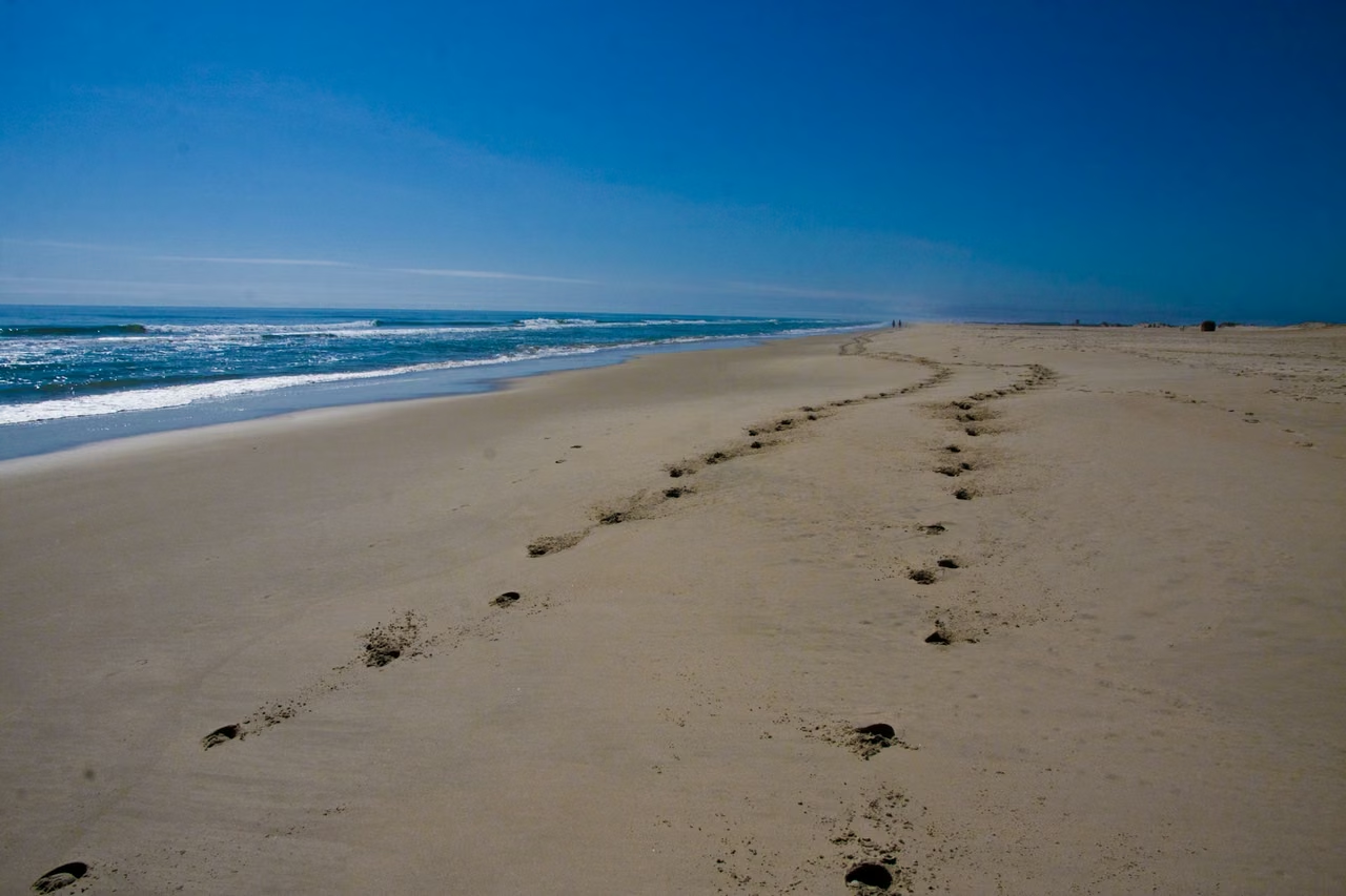
Atlantic coast · Assateague Island
At last, the wind from the open ocean.
The Chesapeake Bay and Atlantic coast are distinct environments. Assateague Island's sand, shoreline, and horses reveal another side of Maryland.
Assateague Island · Maryland's coast
The wild horse herds on the island are descendants of domestic horses, not wild horses. The National Park Service warns people to keep a distance and not feed or touch the animals.
Islands span Maryland and Virginia, with boundaries and differing management methods on both sides. Understanding a place's natural environment also involves distinguishing between legends, animal origins, and actual management practices.
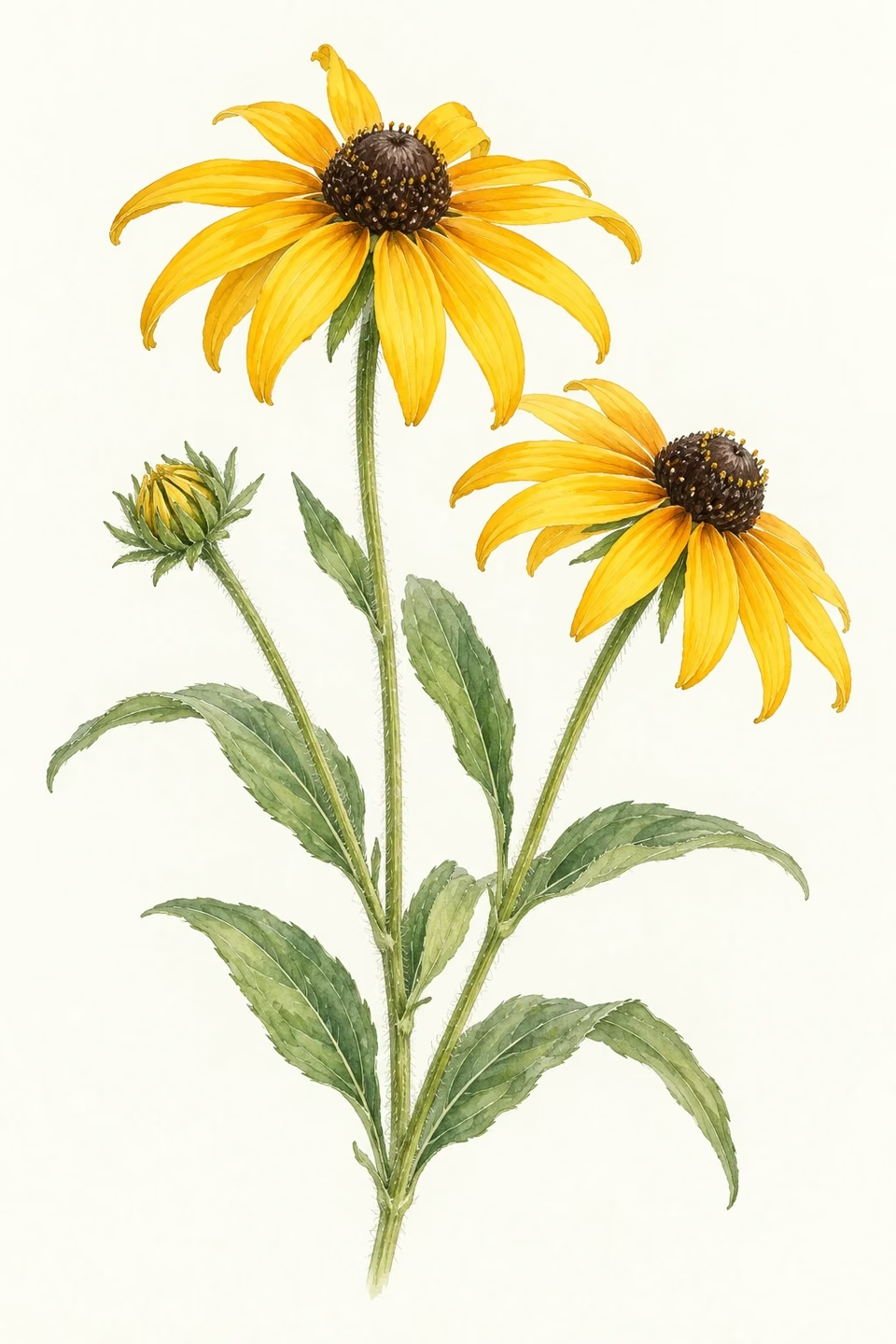
State flower · Black-eyed Susan
A little yellow beside the coastal blue.
Maryland designated the black-eyed Susan as its state flower in 1918. Its dark center and golden petals form one of the state's familiar natural symbols.
From coastal villages to port districts, from Liberty Way to space research, and through the Western Canal, Maryland's story remains multifaceted. Every stretch of coastline, every town, deserves a closer look.
Black-eyed Susan · State flower illustration
STATE.REPORT
An editorial feature by STATE.REPORT. Image creators and licenses are credited below.