
Rain and snow replenish groundwater, which enters the rock through fractures.
River valleys, towns, and collections in the woods
Arkansas
Follow the river. Let the landscape unfold.
State capitalLittle Rock
Population · 2025 estimate3,114,791 people
Ozark Mountains · Ouachita Mountains · Eastern plains
135miles, approximately 217 kilometers
Protected National River corridor
Protected National River corridor
A river free to follow its bends.
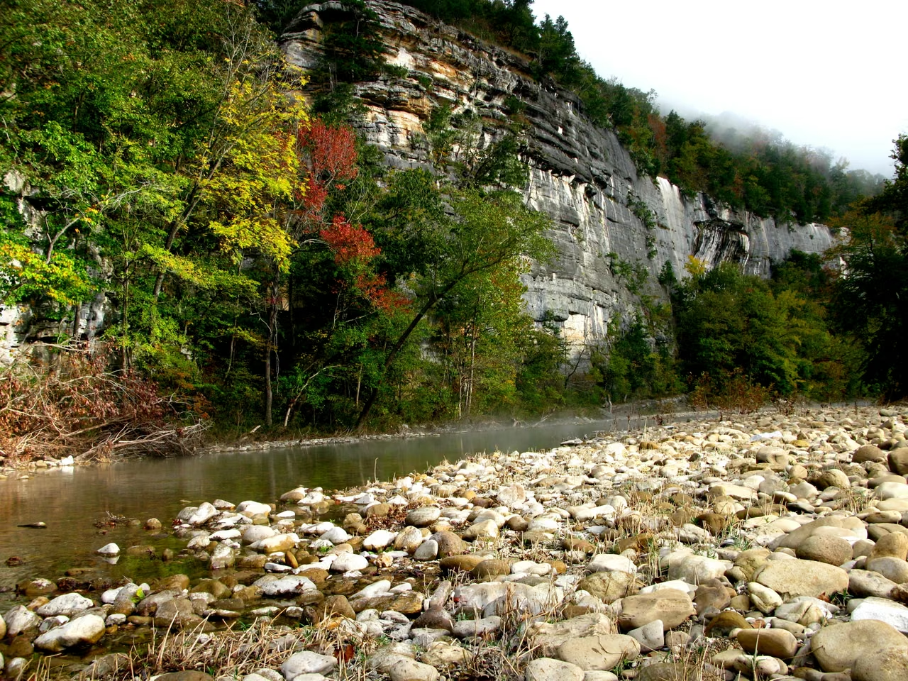
The Buffalo River rises in the Boston Mountains and flows east to the White River. Its valley crosses the Ozarks, where limestone, dolomite and sandstone form varied bluffs. Forests reflect in the water beneath rock layers that record a much longer history.
In 1972, it became the first national river in the United States. The protection includes both the waterway and the rock walls, caves, and riverbanks along the path. The underground water and cave systems in the limestone region are equally important beyond the surface.
The National Park Service directly manages only about one-tenth of the watershed. Upstream land use, private property and community life still affect the river, so conservation must reach beyond park boundaries to the watershed as a whole.
Rainwater warmed deep within the earth.
Water travels deep underground and is warmed by the Earth’s natural heat.
Warm water flows back to the surface along the channel, becoming a spring.

62°C, approximately
Earth’s heat, without an underground volcano.
The National Park Service gives the springs’ average temperature as approximately 62°C. The water begins as precipitation and circulates underground for a long period, warming with the natural increase in temperature at depth. Its heat does not come from magma.
Geology shaped the town itself. Bathhouses, streets and public spaces grew around the springs, making a natural phenomenon part of city life. A visit to Hot Springs reveals both the landscape and a history of how people used water and built a town around it.
Hot springs themselves do not prove any therapeutic effects. Understanding how the water forms is more interesting than adding magical descriptions to it.
Architecture makes room for water and woodland.
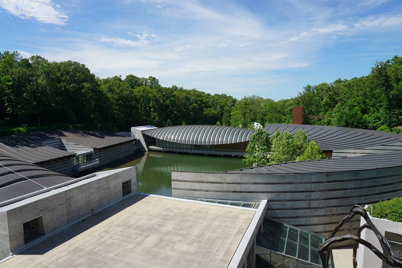
Moshe Safdie designed Crystal Bridges around a natural ravine, spring-fed ponds and a series of pavilions. Bridge-like buildings span the water, bringing visitors close to the woods as they move through the museum.
Art viewing thus has an outdoor rhythm. Entering the gallery, walking to the water's edge, and then entering the path, the building and its surrounding landscape are not two unrelated parts. The photo records the building's appearance in 2017.
A headquarters city with a neighborhood life.
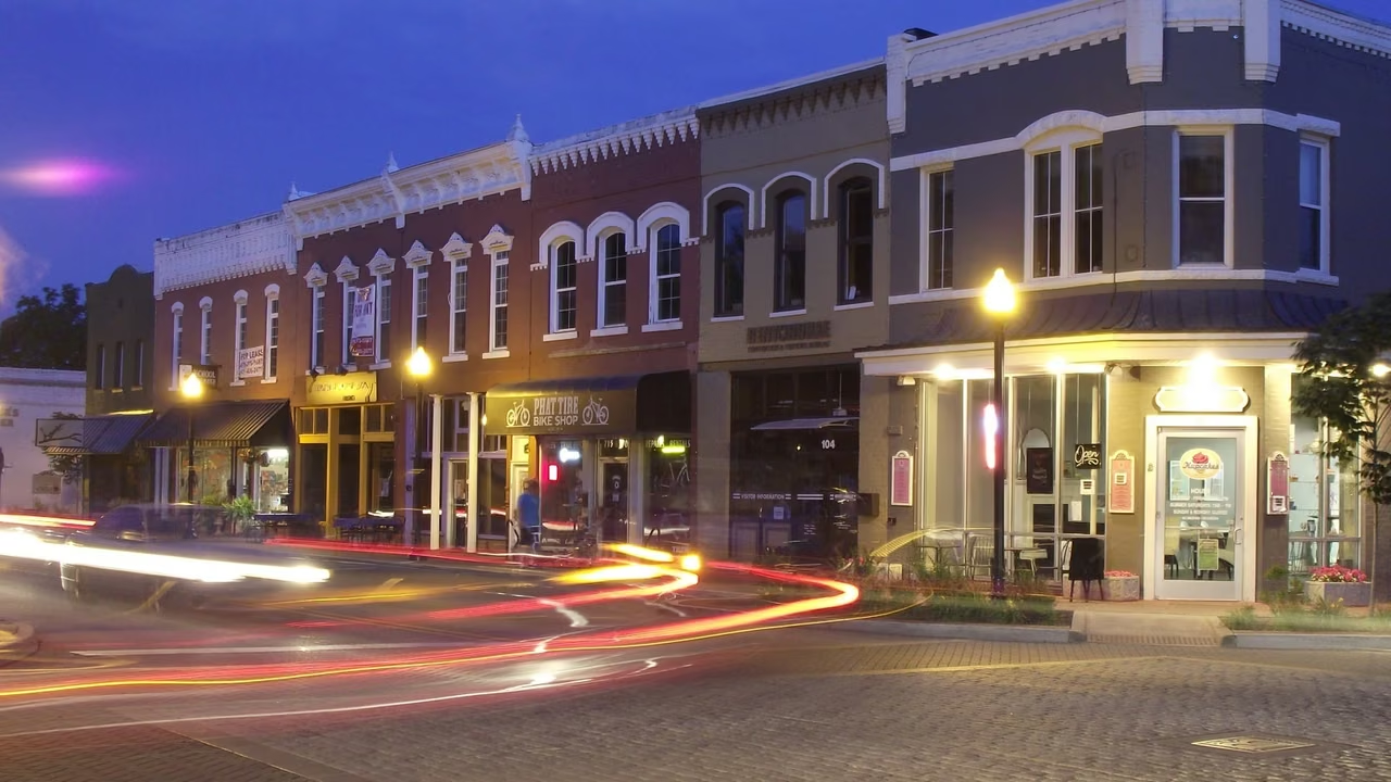
Bentonville is home to Walmart’s headquarters. The new campus, which opened in 2025, continues the retailer’s long relationship with the city. Purchasing, supplier collaboration, and related professional services are important parts of the local business environment.
Beyond the scale of the corporation, downtown restaurants, cultural venues, and residents’ daily lives offer another view of the city. Serving a large corporate client requires different locations, teams, and delivery arrangements from running a neighborhood business.
A university brings young people into the city.
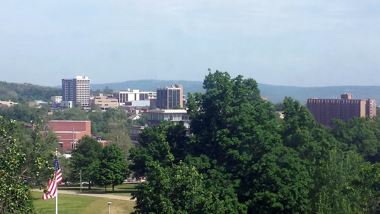
University of Arkansas was established in 1871 and its main campus is located in Fayetteville. Teaching, research, student life, and the local community are interconnected, making the city a significant node in the state's northwest.
Northwest Arkansas is not simply one extended city. Bentonville’s corporate headquarters and Fayetteville’s university create different needs. Businesses choosing a location should compare customers, available skills and everyday commutes, rather than rely on a regional label alone.
Corporate Info: Walmart's New Headquarters Inauguration Announcement: January 17, 2025.
Eastern plains · The 2025 rice crop
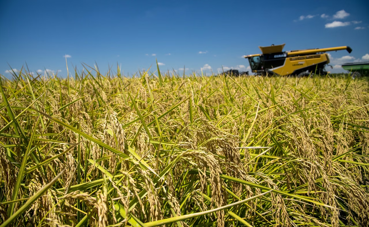
Beyond the mountains, rice fields open out.
45.2%
Arkansas’s share of U.S. rice production in 2025.
From field to processing plant.
University of Arkansas extension figures put the state’s 2025 harvested rice area at approximately 1.25 million acres. Rice is grown in about 40 of the state’s 75 counties, mainly in the east, with additional production in the Arkansas, Ouachita and Red River basins.
Irrigation, agricultural machinery, drying and storage after harvest, milling, packaging, and transportation are all parts of agricultural operations. For service companies in this sector, knowing the seasonal schedule and the location of the farms is more practically useful than just knowing the total state production.
Production share does not equate to profit share. Factors such as grain prices, input costs, water conditions, and weather impact the outcome; a picture of a bountiful harvest cannot replace the true financial performance of a particular year.
Source: University of Arkansas agricultural extension rice resources, 2025 statistics. The photograph was taken in 2020 to illustrate harvesting; it does not document the 2025 crop.
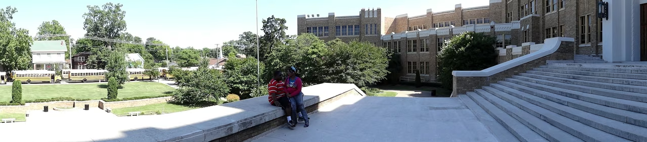
Entering a classroom once required extraordinary courage.
1957Little Rock Nine
In 1957, nine black students sought the opportunity for equal education at the Central High School in Little Rock. They faced obstruction, threats, and hostility; subsequently, the federal government intervened to protect the students' entry into the school. Central High School thus became an important location in the history of desegregation of schools in the United States.
History is not just preserved in buildings. The names of students, their personal experiences, the challenges they faced on campus, and the persistence of their families and supporters give this event a specific human dimension.
Today, viewing school buildings should connect the solemn architecture with the unequal reality of the past. The records preserved by the National Park Service and the National Archives can help readers understand the distance between court decisions, federal actions, and everyday campus life.
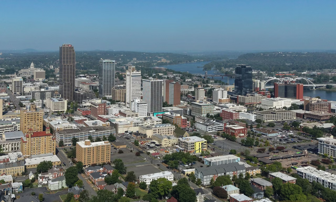
Little Rock, the state capital, is also a center for government, healthcare and regional services. Communities along the Arkansas River differ from the university and corporate headquarters cities of the northwest and the agricultural counties of the east. These regional differences shape both everyday life and employment.
The unseen work that makes a site usable.
$25million
2026 Industrial Site Development Grants
In April 2026, the Arkansas Economic Development Commission announced $25 million in industrial site development grants. Supported work includes infrastructure, drainage, soil studies, grading and preliminary investigations.
This is an announced funding program, not a claim that every site is finished or that an equivalent amount of economic output has been created. It shows how a business location depends on land conditions and preparation as well as buildings.
Manufacturing and logistics: start with the site.
Power supply, water supply and drainage, and the distance to entry points and transport routes all affect the use of factories or warehouses. Being close to customers and being close to raw materials may point towards different locations, and one should compare the facility conditions and daily transportation together.
Food and agriculture: plan around the seasons.
Farm services, processing, and transportation work at different paces. Teams and equipment need to be available when actual needs arise, and especially in regions with a higher agricultural content, considerations for seasonal hiring and cash arrangements are necessary.
Company formation and business operations: separate requirements.
After company establishment, tax registration and permits still need to be organized based on business activities. Employees, merchandise sales, vehicle transportation, and establishments may involve different matters, and the establishment documents should not be considered the complete set of startup procedures.
Industries & establishments · 2023
The work that keeps communities running.
The state's healthcare and public services, the commercial and university environment in the northwest, and agricultural and processing activities in the eastern plains, together form Arkansas's local economy. The statistics provided mainly cover non-agricultural establishments, so they cannot fully measure the scale of farm employment.
The state recorded 70,452 employer establishments and 1,120,356 paid employees. A single company may operate several stores, offices, or factories, so establishments are not a count of registered companies.
U.S. Census Bureau, 2023 County Business Patterns. The series primarily covers private, nonfarm establishments with paid employees. Employment is measured for the pay period that includes March 12. The 2023 release was the latest in this series available when checked; it is not a measure of current monthly employment.
Facility funding details: Arkansas Economic Development Commission announcement of April 28, 2026. Refer to state government enterprise services and fiscal department guidelines for registration items.
State Flower · Apple Blossom
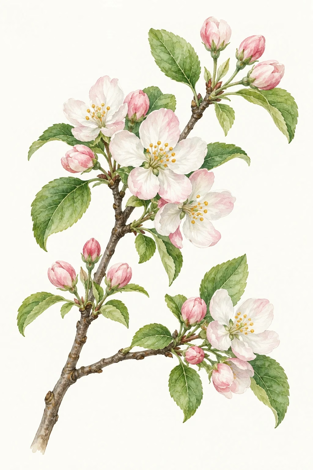
A little spring among the branches.
The apple blossom is the state flower of Arkansas. It preserves a memory of local orchards and agricultural life, adding a light floral touch to the state's image beyond the mountains, rice paddies, and cities.
Walking along the river valley into the forest, then to the hot spring city and the plains, one sees that this is not just one kind of scenery. Geology, agriculture, art, and public history leave their own parts worth looking into.
STATE.REPORT
An editorial feature by STATE.REPORT. Image creators and licenses are credited below.
Sources & further reading
Population estimates ↗
U.S. Census Bureau: state population estimates for July 1, 2025.
The Buffalo River and Basin
National Park Service: National Rivers, Watersheds, and Conservation Areas.
The river valley’s geology
National Park Service: Ozark Geology, Layers, and Rivers.
Where Do Hot Springs Come From?
National Park Service: Precipitation, groundwater circulation, and natural ground temperature.
The geological environment of thermal springs.
National Park Service: nonvolcanic geothermal heat and rock formations.
The architecture of Crystal Bridges
Crystal Bridges Museum of American Art: the ravine, ponds and architectural design.
University of Arkansas ↗
University of Arkansas: its founding in 1871 and the Fayetteville campus.
Little Rock Nine
National Park Service: the 1957 enrollment crisis and school desegregation.
The federal government and the Little Rock crisis ↗
National Archives: Executive Order 10730 and its historical context.
State Flower and Local History ↗
Arkansas Secretary of State: the apple blossom and state symbols.
Image credits & licenses
Morning on the Buffalo River.jpg · OakleyOriginals · CC BY 2.0。
Little Rock, Arkansas skyline.jpg · Quintin Soloviev · CC BY 4.0。
Central Avenue at night.jpg · Alfredo Carrillo · CC BY 2.0。
Downtown Fayetteville from Old Main 001.jpg · Brandonrush · CC BY-SA 3.0。
Steamy Entrance Springs on Cold Night in Hot Springs National Park.jpg · TripOfALifestyle.com · CC BY 4.0。
Crystal Bridges Museum of American Art May 2017 01.jpg · Michael Barera · CC BY-SA 4.0。
Panorama of Exterior of Central High School - Little Rock - Arkansas - USA.jpg · Adam Jones, Ph.D. · CC BY-SA 3.0。
Rice Harvest 2020.jpg · Ark. Agricultural Experiment Station · CC BY 2.0。