A capital on the Potomac
The Residence Act designated an area for the permanent national capital. From the beginning, the seat of the federal government had a constitutional position different from an ordinary city within a state.

District of Columbia
A national capital. A city called home.
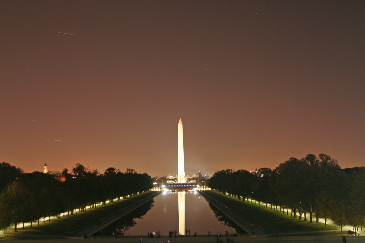
Looking towards the Washington Monument from the Lincoln Memorial, a clear axis unfolds between the water, lawn, and buildings. This is where the American capital, familiar in news, images, and history textbooks, operates its national institutions, preserves public memory, and where crowds express opinions.
Look away from the axis, and another side of the city reveals itself. Markets have residents coming to buy groceries, queues form at the theater entrance, and paths along the river connect the community. Washington has both national public institutions and places that need care for schools, transportation, housing, and local businesses.
The District of Columbia is a federal district and not the 51st state of the United States, nor is it the state of Washington, Northwest. When reading population, employment, and tourism data, it is important to distinguish between the District itself and the Washington Metropolitan Area that spans parts of Maryland and Virginia; their boundaries are not the same.
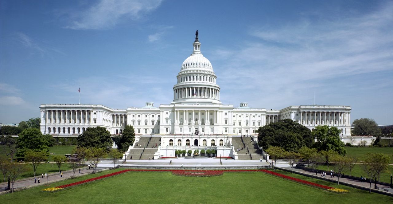
The Capitol is located at the eastern end of National Mall, where both the Senate and the House meet. Below the white dome is the ongoing legislative body; the paintings and sculptures in the round chamber link the political space with art and history.
West along the plaza, the open public space is comprised of a lawn, a museum, and memorials. The monuments point towards different historical figures and events, and gatherings and daily visits continually add new experiences to this space.
The Residence Act designated an area for the permanent national capital. From the beginning, the seat of the federal government had a constitutional position different from an ordinary city within a state.
Pierre Charles L'Enfant was commissioned to plan the capital. A grid of streets intersected by diagonal avenues links important public buildings through roads and sightlines, providing a framework for understanding the city.
The Home Rule Act established the modern elected mayor and council. The District manages local affairs within a distinctive framework of congressional oversight.
Diagonal avenues cross a regular street grid, with squares and public buildings anchoring the city. This early plan records the vision for Washington as a new national capital.
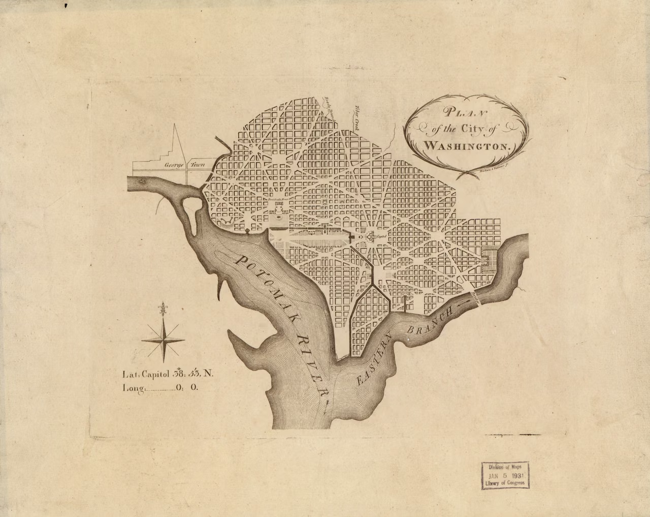
This is a historical blueprint, not a contemporary map of streets and administrative boundaries. The rivers, roads, and public spaces have changed over time, but the initial city conception can still be identified in the relationship of diagonal avenues and squares.
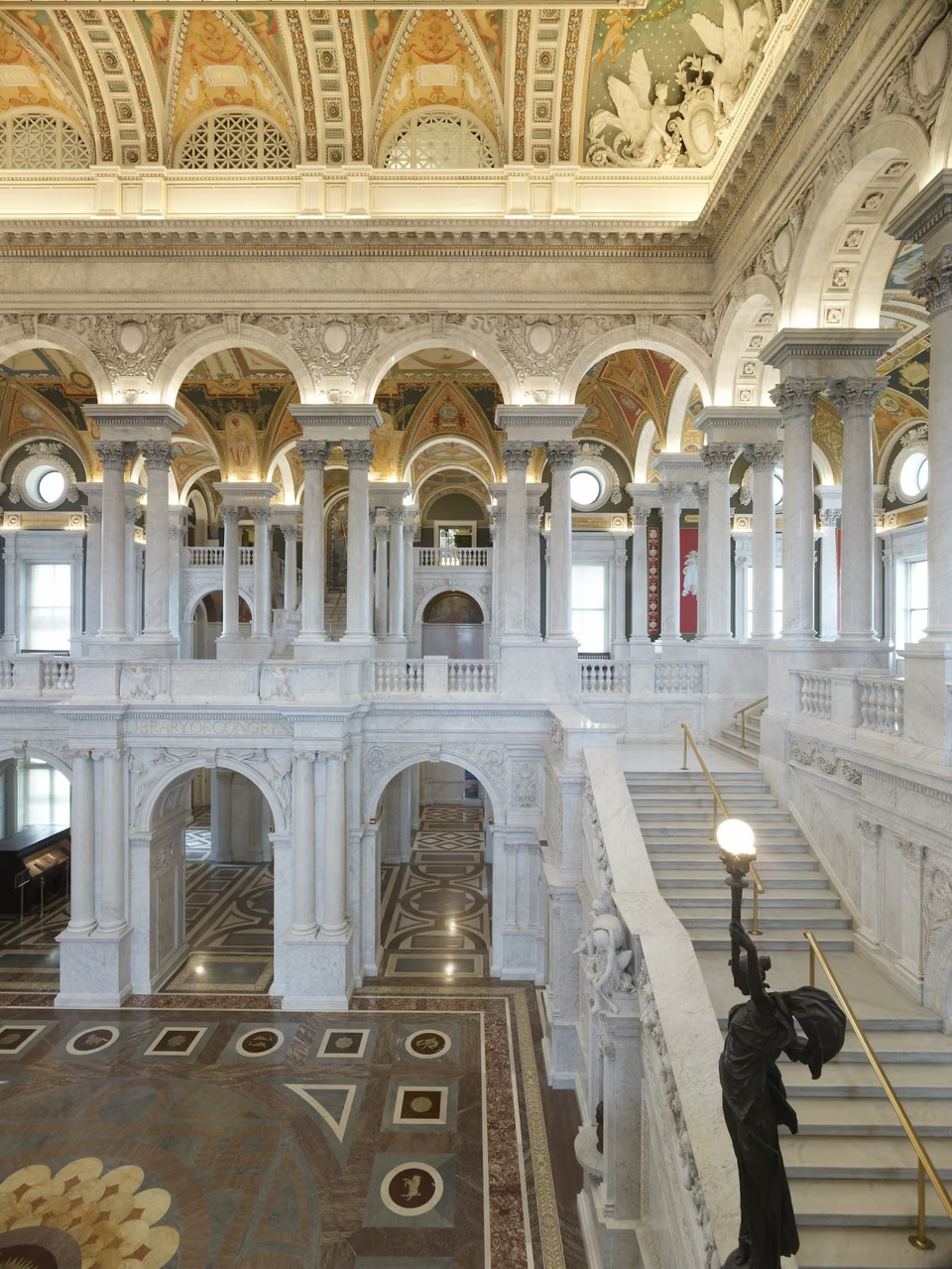
The Thomas Jefferson Building opened to the public in 1897. Nearly fifty artists contributed to its decoration, bringing painting, sculpture and inscriptions into a public space devoted to reading. The Great Hall’s two tiers of arches and marble staircases draw the eye upward toward the vaulted ceiling.
Floor designs include a compass and the zodiac; murals depict knowledge, professions, and civilization. The ceiling uses aluminum-leaf decoration, a material still considered precious at the time. Above the staircase, Elihu Vedder’s Minerva mosaic links the goddess of wisdom to the library’s purpose.
Beyond the architecture, books, maps, manuscripts and images preserve experiences from many periods. Admiring the Great Hall and consulting the collections are different kinds of visit. Exhibitions, reading rooms and research services have separate arrangements; allow time for reader registration when planning detailed research.
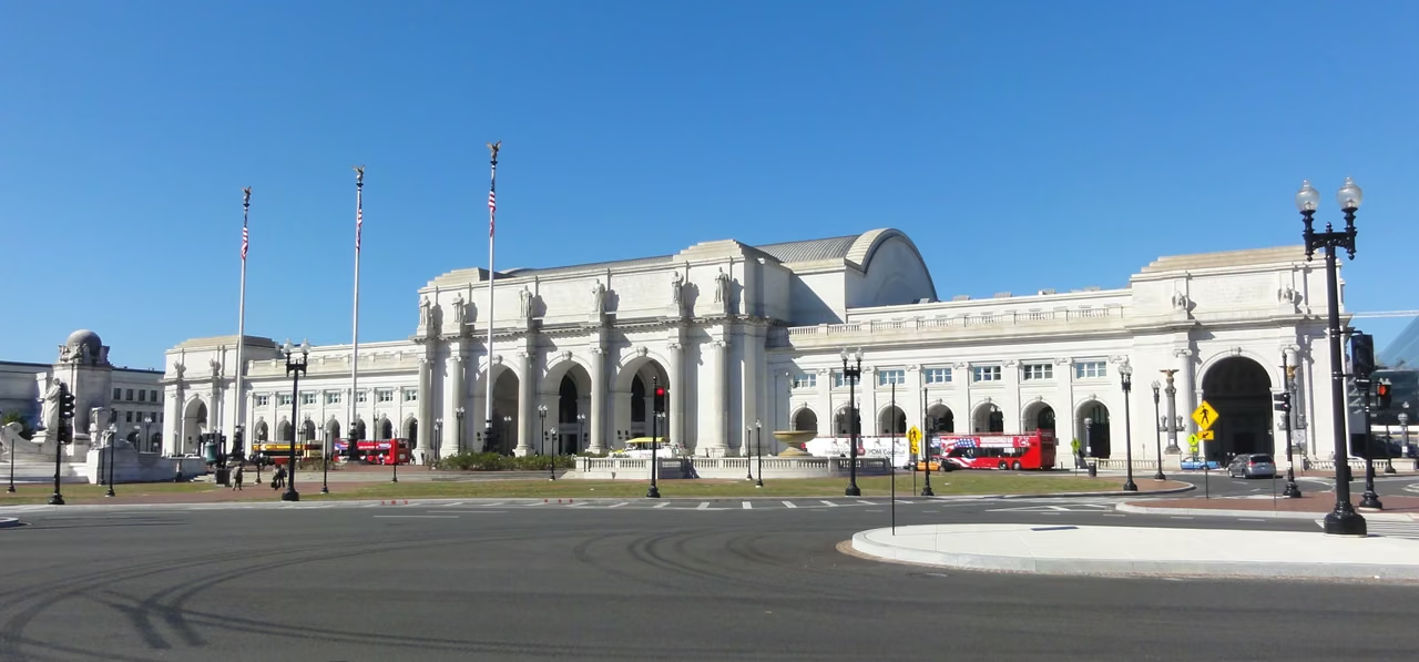
Union Station was designed by architect Daniel Burnham and began operations in 1907, with construction completed in 1908. The wide arcades, sculptures, and waiting spaces make the transportation building an integral part of the city's public image.
The station brings both distant travelers and daily commuters into the same space. Here, travelers form their first impression of Washington, while residents regard it as a path for work, visiting, and returning home. Under the scale of grand architecture, specific journeys are constantly occurring.
Beyond the station, Capitol Hill’s public buildings, homes, and Eastern Market follow their own rhythms. The capital’s ceremonial life and its daily routines meet naturally in the streets.
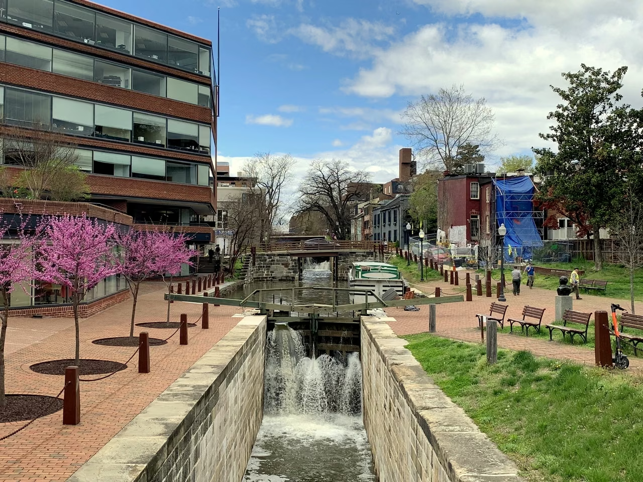
The canal began construction in 1828, transporting inland goods to the Potomac River. Floods and competition with railroads ended the transport industry in 1924, but the waterway, locks, and towpaths preserved another city rhythm.
Today, walking along the canal allows one to re-integrate shops and old streets into the historical understanding of transport: how goods arrived, how labor was organized, and how the riverbank evolved into recreational and public spaces. Heritage preservation also requires ongoing maintenance, not merely keeping old facilities frozen in a particular era.
Union Station's crowds, Capitol Hill's homes, and Georgetown's old waterway reveal a city shaped across generations. Public buildings define the capital's skyline; streets connect commuting, shopping, neighborhood encounters, and leisure.
This is not a continuous walking route, but rather three perspectives on the capital: a transportation hub, a transport legacy, and the people living between them.
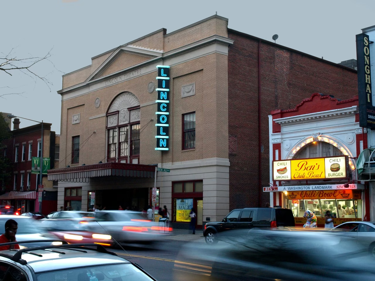
The Lincoln Theatre has its entrance facing the street, and performances are part of the nighttime life shared with surrounding shops. For residents, the theatre is not a solitary attraction; it is also connected to gatherings, work, and intergenerational memories.
Washington’s homegrown go-go music is known for its continuous rhythms and exchange between performers and audiences. In 2020, the District named it its official music. Created within local African American communities, it is a living part of the city’s culture.
The Anacostia Community Museum was founded in 1967 and preserves history through the experiences of the community and its residents. Oral histories, household items, and community actions ensure that urban narratives do not solely revolve around national institutions.
It focuses on art, community ties, and urban waterways, and reminds readers that the cultural depth of a capital city comes from its residents' continuous storytelling, preservation, and re-understanding of their lives.
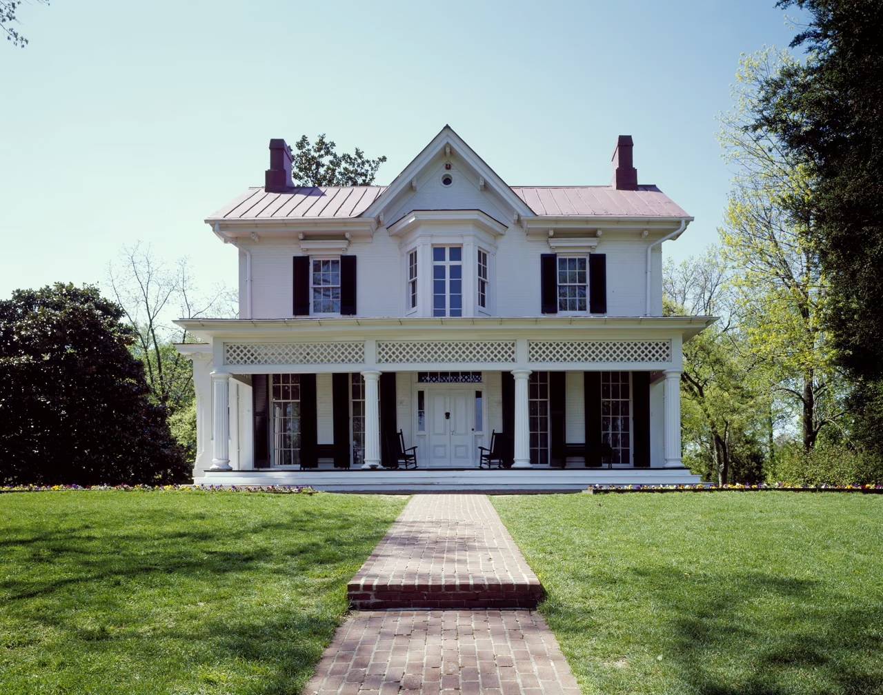
Frederick Douglass purchased Cedar Hill in 1877 and lived there until his death in 1895. His home in Anacostia brings the public life of an abolitionist, writer and orator into an intimate setting of rooms, a desk and a family home.
In a historic home, buildings and objects are more than a backdrop. They show how public action also depended on reading, writing, meetings, and daily work. A particular living space can bring a major historical figure closer to view.
Howard University was founded in 1867 and is an important site for understanding the history of African American education in the United States. The university's teaching, research, and professional training extend Washington's cultural life into the classroom, laboratory, and public discourse.
Howard University's Moorland-Spingarn Research Center preserves materials documenting the history and culture of Africa and people of African descent. Collecting, cataloging, and research bring individual experiences into lasting public memory and give future scholars evidence for new questions.
Federal agencies, diplomatic missions, and international organizations share this city. Their different roles help explain the capital’s distinctive place in national and global affairs.
The U.S. Constitution gives the seat of the federal government a special status. Congress holds constitutional legislative authority over the District, while its local government manages municipal affairs under home rule. Schools, streets, and public services are part of everyday life in the national capital, too.
Thus, "Washington" can refer to federal politics or to the local city. The former pertains to national policies, while the latter concerns residents' lives; they coexist on the same land but are not easily equated.
Embassies of foreign countries are located in Washington, where they maintain diplomatic relations with the US government. Diplomatic activities include formal meetings, as well as consular affairs, cultural exchanges, and everyday communications.
Embassy buildings and diplomatic activities make the capital a specific site for international relations. However, a single embassy does not equate to a country's entire culture. To understand different societies, one must venture into their history, languages, and lived experiences.
The headquarters of the World Bank Group and the International Monetary Fund are both located in Washington. Various regions' people continue to exchange on topics such as development, economic cooperation, and international finance in this city.
These entities have their own membership and governance arrangements and are not subordinate departments of the US government. Geographical proximity indicates important international activities here; understanding their roles requires distinguishing their responsibilities and decision-making processes.
The initial territory of the capital is not entirely the same as today. In 1846, the Alexandria region, originally part of the District of Columbia, was returned to Virginia. Today, crossing the Potomac River is quite common, but administrative boundaries still exist. Arlington and Alexandria, which border the District, are not part of the District. When reading metropolitan area data, this distinction should be maintained.
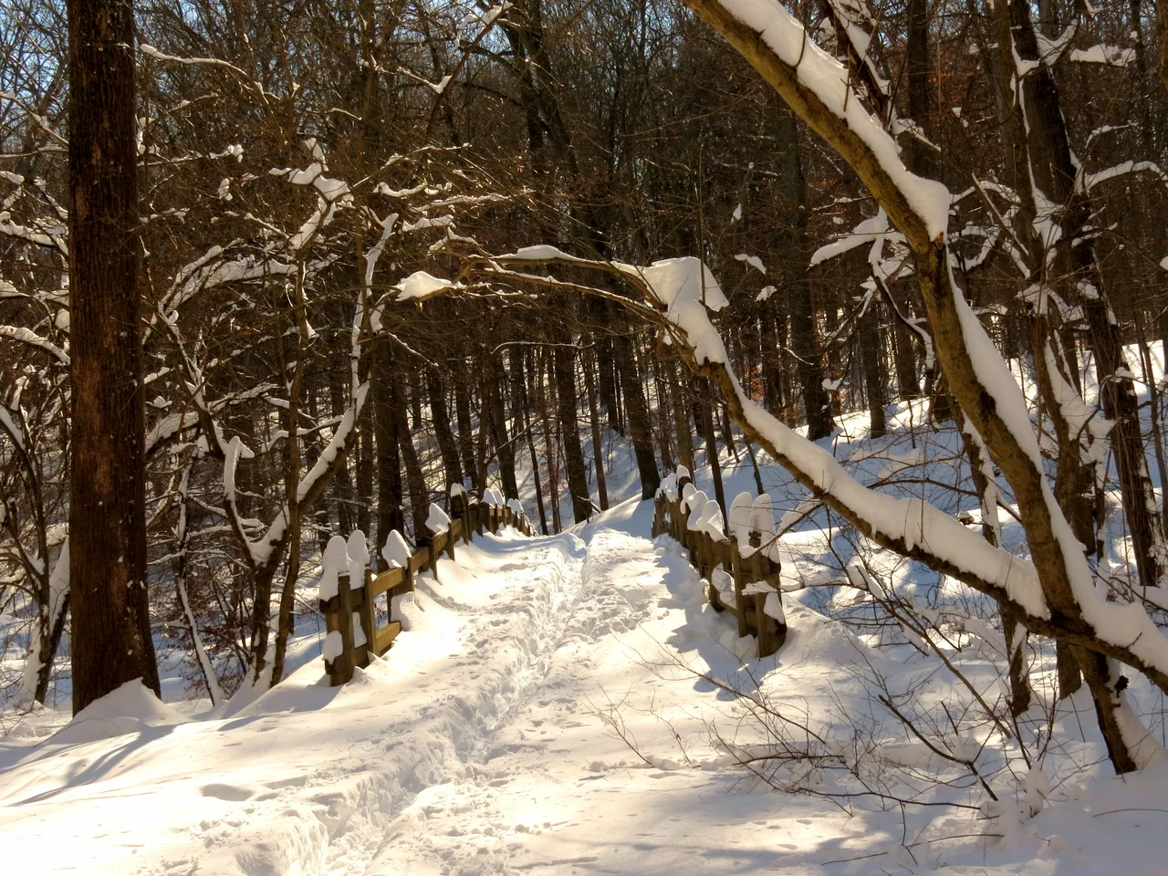
Established in 1890, Rock Creek Park offers a different kind of space within the dense city. Its wooded valley and trails let people walk, observe the seasons and follow the changing water and terrain.
Parks are not the blank spaces of urban life. Walkways, historical sites, vegetation, and water bodies all require management; even in the woods, one can observe how public spaces are maintained.
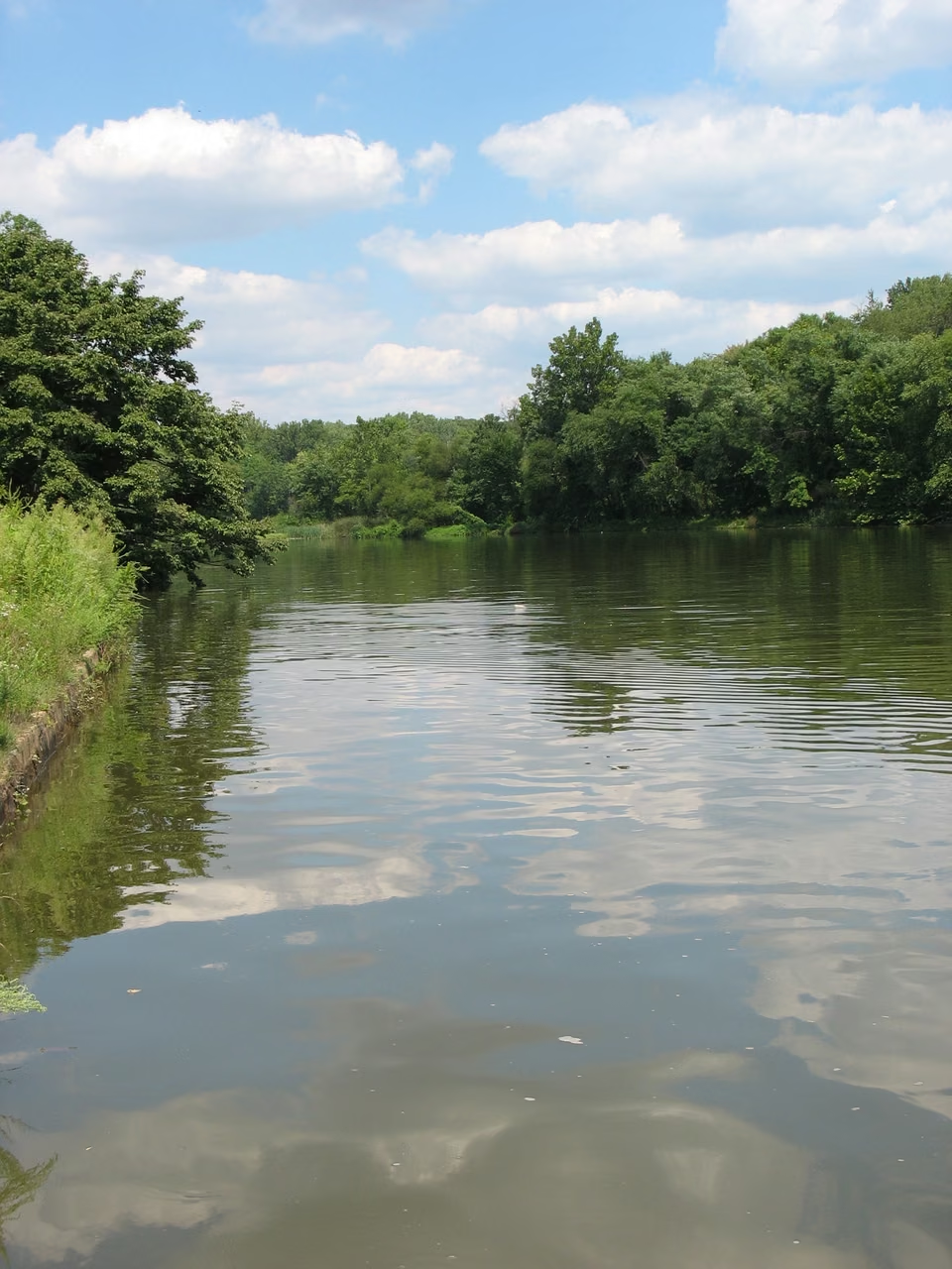
This river connects the environment with the community lifestyle. The community museum records residents' actions in protecting the urban waterway, documenting both natural changes and the process of striving for public spaces along the riverbank.
Conditions of passage in different river segments vary. The photo presents a particular view, but a full understanding of the river requires combining knowledge of coastal communities, historical usage, and ongoing conservation efforts.
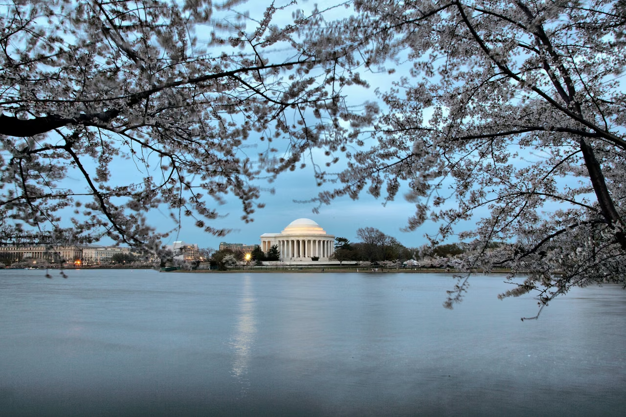
In 1912, cherry trees gifted by Japan were planted in Washington, D.C., and have since grown into a widely known seasonal spectacle. The cherry blossoms bring diplomacy into the realm of seasonal experiences: trees require care, and the bloom period varies with weather, meaning cities do not always wait for a fixed date.
The water's edge, memorial buildings, and flowers together create the scenery. Beyond viewing the flowers, maintaining the trees, protecting the shoreline, and allowing for public passage are also parts of this spring gathering.
Washington D.C. may be a history lesson, a performance, or a family trip for visitors; for residents, it is also a home that requires daily care.
Washington Tourism Promotion Agency released the 2025 statistics in May 2026. These statistics represent annual visitor numbers, not the number of people in the city at any given moment, nor the permanent residents of the district.
Museums, memorial spaces, and cultural activities allow many to encounter unfamiliar history for the first time. The meaning of the visit is not just in the number of places visited, but also in reading a label, noticing an object, or hearing a sound previously unknown.
Residents and visitors share roads, parks, and public facilities. Avoiding congestion, respecting memorial spaces, and allowing room for community life are parts of getting to know the capital. Beyond its grand public buildings, the city's warmth often comes from specific people and encounters.
The flag consists of three red stars on a white background with two red stripes. It was approved for use in 1938 and is based on the Washington family crest. It appears in places familiar to its residents, expressing its own identity as the capital.
Monuments, books, markets, music, and riverbanks offer different ways into Washington. The national capital's grandeur exists alongside the richness of its neighborhoods.
An editorial feature by STATE.REPORT. Image creators and licenses are credited below.
Architect of the Capitol: Building history, legislative spaces, and public art.
U.S. Census Bureau estimates the population as of July 1, 2025.
National Park Service: L'Enfant and the 1791 plan for the capital.
Congressional Research Service: The history and institutions of District governance.
National Park Service: The National Mall and city planning.
Library of Congress: Built, painted, and decorated in 1897.
Eastern Market: A public market that has existed since 1873.
National Park Service: Canal Construction, Transportation, and Closure.
Smithsonian Institution - Anacostia Community Museum: Community Collections and Local History.
District government: The official recognition of go-go music in 2020.
Washington Tourism Promotion Agency: Annual Tourism Statistics released in May 2026.
National Park Service: A History of Urban Parks since 1890.
National Park Service: History of Cherry Blossom Donations, Plantings, and Exchanges.
Office of the Secretary of the District of Columbia: Three red stars, two red bars, and the flag's history.
Union Station: Burnham's design and the station's history.
National Park Service: Frederick Douglass's home from 1877 to 1895.
Howard University: Educational History and African American Cultural Collection.
US State Department: Functions of Embassy and Consulates in the US.
World Bank Group: Headquarters and Contact Information.
International Monetary Fund: Headquarters in Washington and contact information.
Washington Monument at Night with the Reflecting Pool.jpg · Cbmtax · CC BY-SA 4.0
Great Hall. View from the second floor west corridor. Library of Congress Thomas Jefferson Building, Washington, D.C. LCCN2007684268.jpg · Carol M. Highsmith · Public domain
Chesapeake and Ohio Canal - Georgetown.jpg · APK · CC BY-SA 4.0
Cherry-trees-evening-dc-tidal-basin - Virginia - ForestWander.jpg · ForestWander · CC BY-SA 3.0 us
Lincoln Theater exterior, evening.jpg · Tim Brown · CC BY-SA 3.0
Riley Spring Bridge - Flickr - treegrow (1).jpg · Katja Schulz from Washington, D. C., USA · CC BY 2.0
Anacostia River.jpg · Jennifer Boyer from Maryland, USA · CC BY 2.0
The District flag is embedded as a vector graphic, drawn from the design published by the Office of the Secretary of the District of Columbia.
United States Capitol - west front.jpg · Architect of the Capitol · Public domain
Union Station Washington DC 24 Sep 2013.jpg · Jason Quinn · CC BY-SA 3.0
Frederick Douglass House in the Anacostia neighborhood of Washington, D.C LCCN2011632184.tif · Carol M. Highsmith · Public domain
1792 Washington City Plan · Andrew Ellicott, revised from Pierre (Peter) Charles L’Enfant; engraved by Thackara & Vallance, Philadelphia, 1792 · Public domain


.jpg)


