STATE.REPORT
Georgia · Deep shade, distant connections

Georgia

Deep shade. Far-reaching connections.

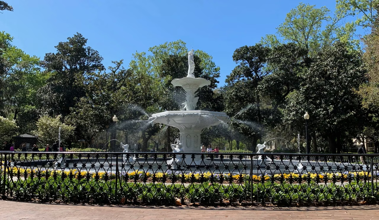
Forsyth Park, Savannah · Fountain, flowers, and shade
Begin in a gardenA slower pace in the city
State capitalAtlanta
Population · 2025 estimate11,302,748 people

Northern mountains / City neighborhoods / Atlantic coast

In Georgia, staying and moving on both matter.

Savannah’s squares invite a slower step; Atlanta’s transport networks carry people far beyond the city. Northward lie the Appalachian Mountains. To the south and east, the land opens into plains, wetlands, and the Atlantic coast.

No single metropolitan area tells the whole story of Georgia. Shade along a neighborhood street, cargo leaving a port, and water moving through a factory or wetland each reveal a different part of the state.

Savannah · Public space at the heart of the neighborhood

First the shade. Then the life around it.

The Historic Square in Savannah dates back to the city planning in 1733. The four squares originally laid out by Oglethorpe mark the beginning of the development of the streets.

Roads, residences, and public lands surround the square, making open spaces recur during walking. Crossing a street, trees, benches, and neighboring buildings create another spot to linger.

The layout's significance goes beyond mere aesthetics. Public spaces and streets remain closely connected, providing venues for residents, shops, and visitors to meet. Today's Savannah continues to preserve and adapt this urban history.
Residential NeighborhoodResidential NeighborhoodPublic
Land use
Square
Shade · Stay
Public
Land use
Residential NeighborhoodResidential Neighborhood
Square and block relationships illustration

An open green gives the surrounding streets a shared center.

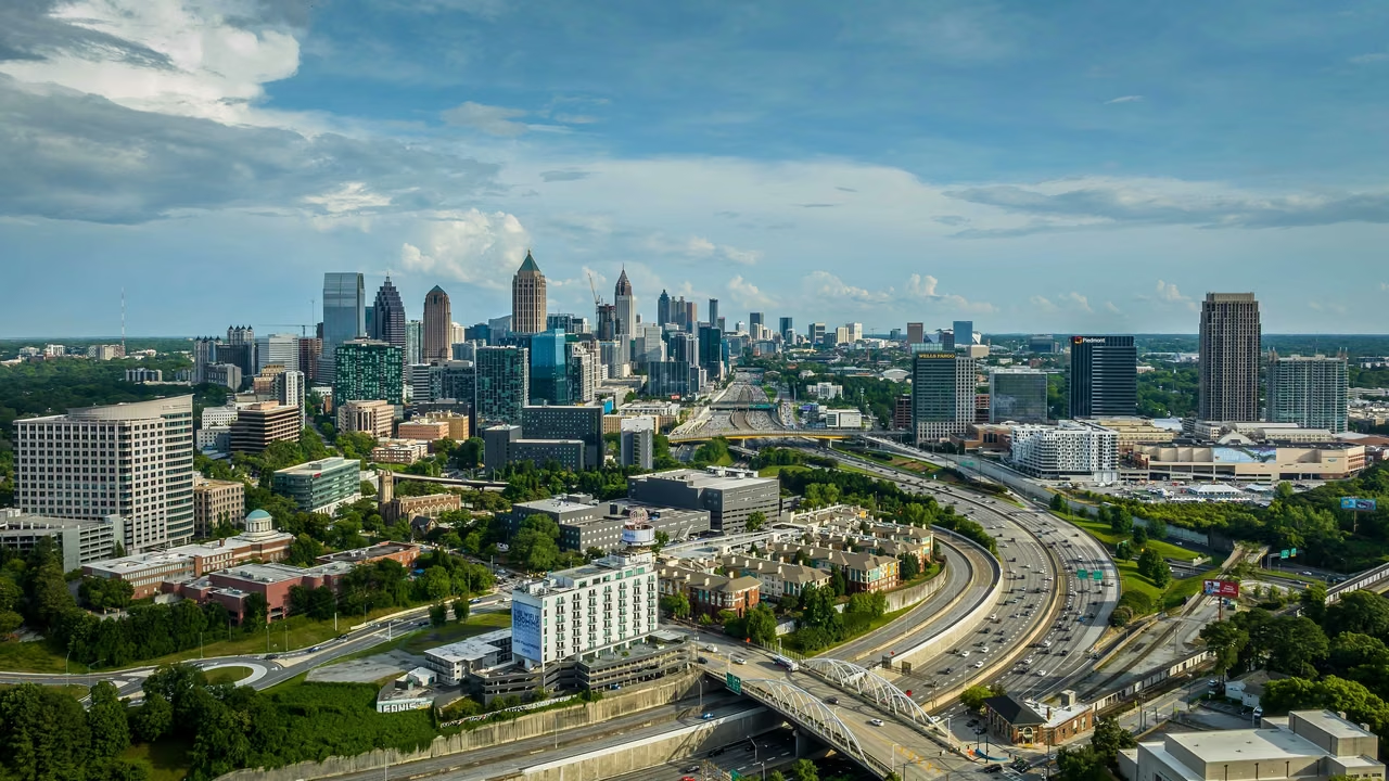
Atlanta · Georgia's capital

As people arrive, the city keeps unfolding.

Atlanta Midtown and Downtown · June 2025

Metropolitan connections reach far beyond the city.

Atlanta's aviation network serves as a crucial entry point to understanding the city's size and external connectivity. Travel, transfers, meetings, and business activities are also connected to accommodations, dining, ground transportation, and various professional services.

However, air passenger traffic is not the same as city visitor numbers. Transfers do not necessarily enter the city, and the same person's multiple trips are counted separately in transportation statistics.

Airport · Fiscal Year 2025About 106.9 million

Total Passenger Arrivals and Departures

Atlanta's aviation department annual financial report shows a decrease of approximately 0.5% compared to the previous fiscal year.
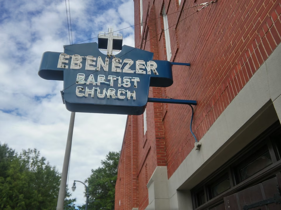
Ebenezer Baptist Church on Auburn Avenue · Atlanta
Auburn Avenue · Public history in the neighborhood

A city’s voice begins in its neighborhoods.

Martin Luther King's birth home and Ebenezer Baptist Church are both in this historic district of Atlanta. The residential buildings, church, and surrounding streets connect the history of the civil rights movement with specific living spaces.

In the late 19th and early 20th centuries, this was an important center for the African American community in Atlanta. Recognizing the growth and public activities of King also requires seeing the background provided by the family, neighborhood, faith, and community organizations.

The history faces the ongoing struggle against racial segregation, inequality, and the pursuit of rights. Preserving neighborhoods and buildings allows later generations to understand how public actions entered the history of cities and nations through real locations.

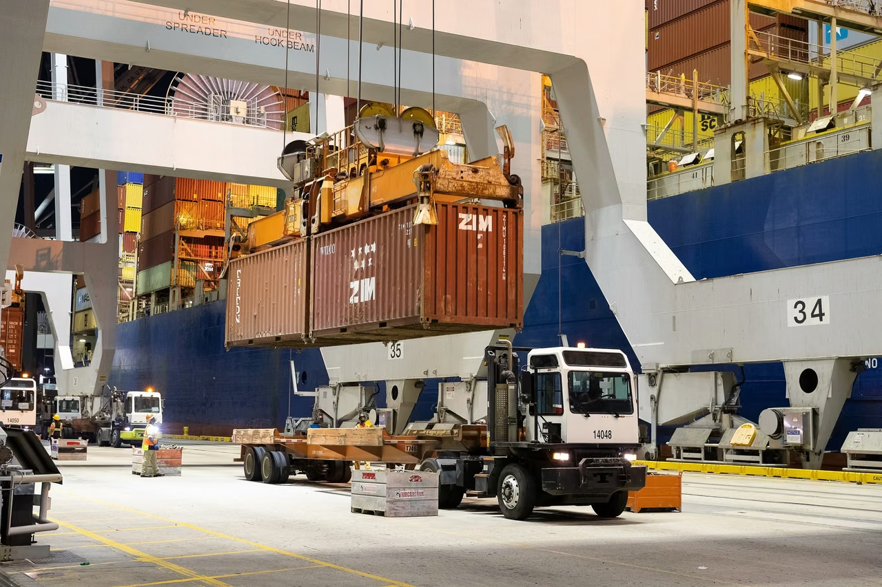
Savannah Harbor · Links the coast to the interior inland.

Many hands behind a single container.

Savannah Port Cargo Handling · 2021 U.S. Customs and Border Protection Photography
2026 Fiscal Year · Container Handling Volume5.67million TEUs

Slightly below the previous fiscal year's approximately 5.7 million TEUs.

Georgia Port Authority released in July 2026. A fiscal year runs from July of the previous year to June of the current year.
Harbor

From ship to shore.

After cargo handling, subsequent transportation arrangements need to be made. TEUs represent a unit of containerized volume, not equivalent to the number of pieces or trade value.

Railroads and highways.

Moving goods inland.

In fiscal year 2026, rail transport accounted for 17% of Savannah's container trade. The Gainesville inland port, which was activated that year, connects Savannah with the industrial region in the state's northeast via rail.

Storage and Customers

The final stretch of the delivery.

Location of storage facilities, box pickup arrangements, inventory turnover, and delivery scope need to align with the customer's region. Port size provides context, with delivery capacity dependent on the coordination among various stages.

Latest Monthly · August 2026

Savannah Harbor handled 529,523 TEUs, a decrease of less than 1% from the previous year; among which, loaded export containers were 117,242 TEUs, up 4.2% year-over-year. Changes in total volume and changes in certain types of goods can differ; these should be observed separately.

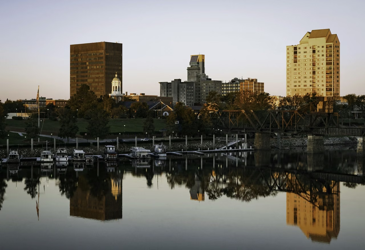
Augusta · Flow and Work

A riverside city that put water to work.

Looking at Augusta Center across Savannah River · 2017

The Augusta Canal, built in 1845, served for power, water supply, and transportation. Later, the introduction of water from the Savannah River spurred the development of cotton mills and other factories.

Today, former industrial sites and public spaces along the canal allow people to access industrial history. The land between the canal and the river upstream also forms a wetland environment within the city.

Compared with Atlanta’s aviation network and Savannah’s seaport, Augusta reveals another relationship between infrastructure and city life: how water is brought in, used and allowed to shape the spaces along its banks.

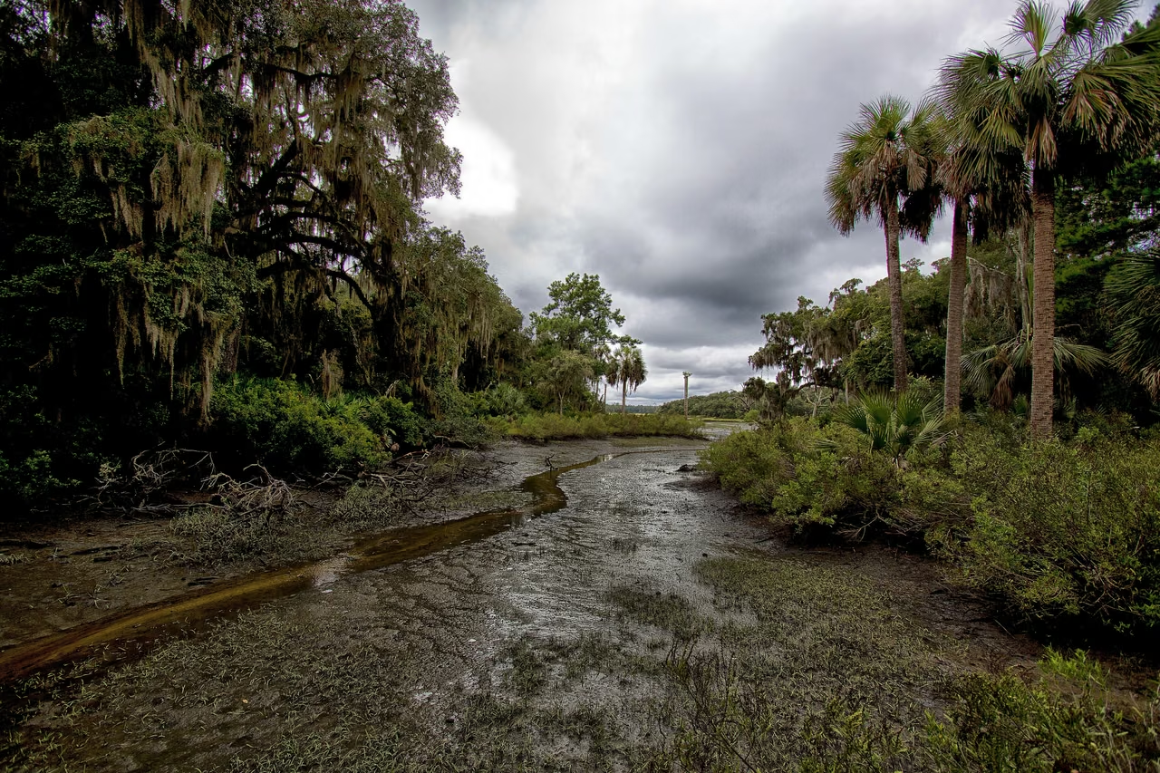
Cumberland Island · The Slow Breathing of the Coast

With the tide, the edges of the land change.

Cumberland Island's tidal creeks and salt marshes border the Atlantic coast.

Salt marshes are living coastal nurseries.

Tides periodically enter the salt marshes and waterways, bringing nutrients while also carrying organic debris. Plants, microorganisms, fish, and birds form a connection in this environment that spans land and water.

Changes in water levels reveal different aspects of the same place. To understand coastlines, one must see both the beach, islands, and the wetlands behind them simultaneously, rather than replacing them with a single coastline.

Trees shaped by the sea breeze.

Cumberland Island's maritime forest consists of plants such as evergreen oaks. Salt and wind affect growth, resulting in curved tree shapes that are traces of environmental effects.

Forests help stabilize the island and provide protection for the interior salt marshes. Though seemingly different forests and wetlands, they actually belong to a connected coastal environment.

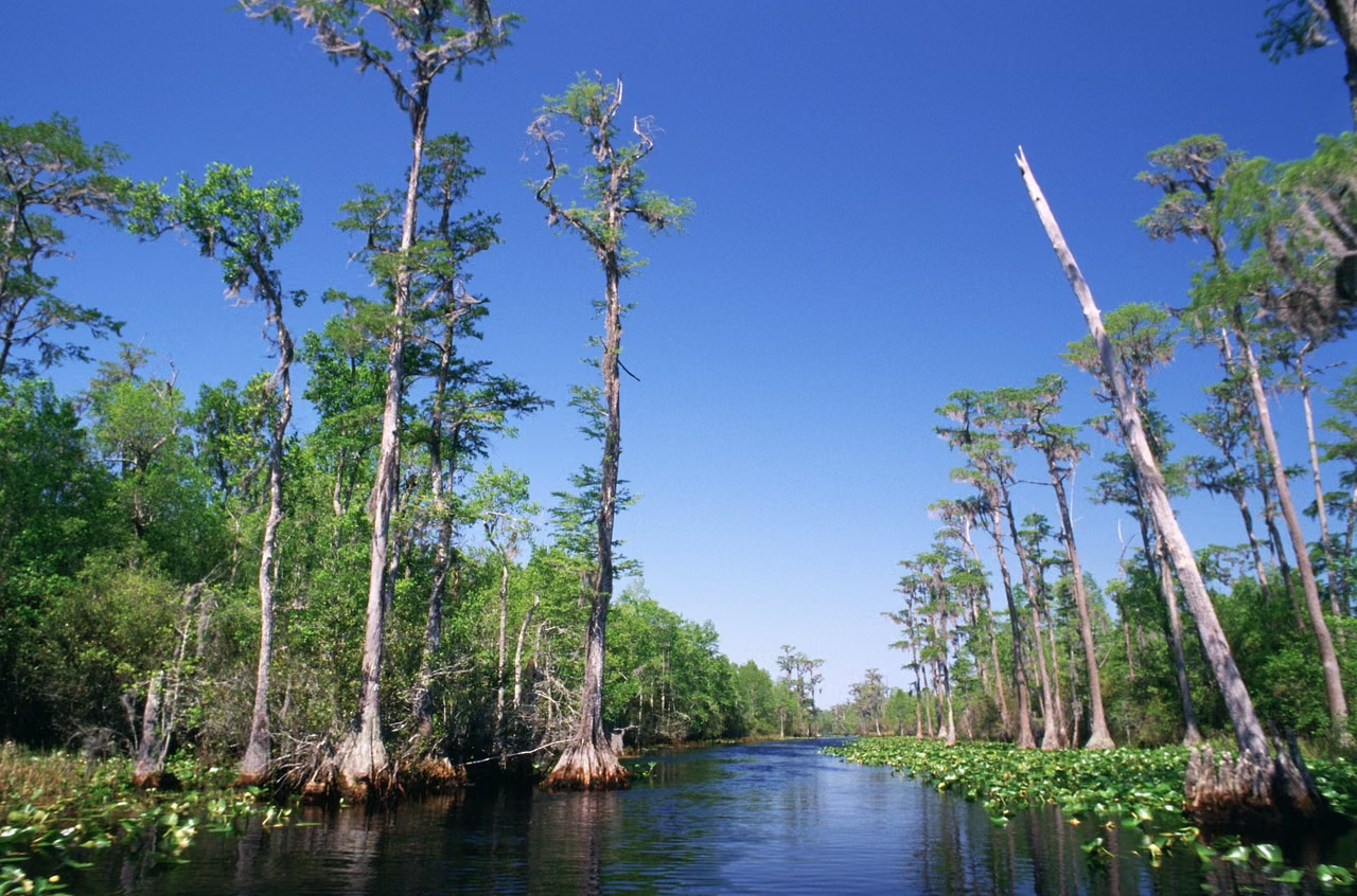
Okefenokee · Inland wetlands

Beyond the tides, another world of water.

Okefenokee Swamp · Bald cypress and open water

The Okefenokee is a landscape composed of broad waters, swamp forests, and peat lands. The water levels, plant growth, and fires constantly change the area's appearance.

It belongs to a different wetland environment from coastal salt marshes. The forest and open wetlands provide habitat for various animals and also preserve important peat resources.

Understanding this natural landscape is not just about identifying a tree or an animal. Where water comes from, how it stays, and how plant debris accumulates are all integral to the life of the wetland as a whole.

Such water,
Coastal and inland areas each have their own pace.
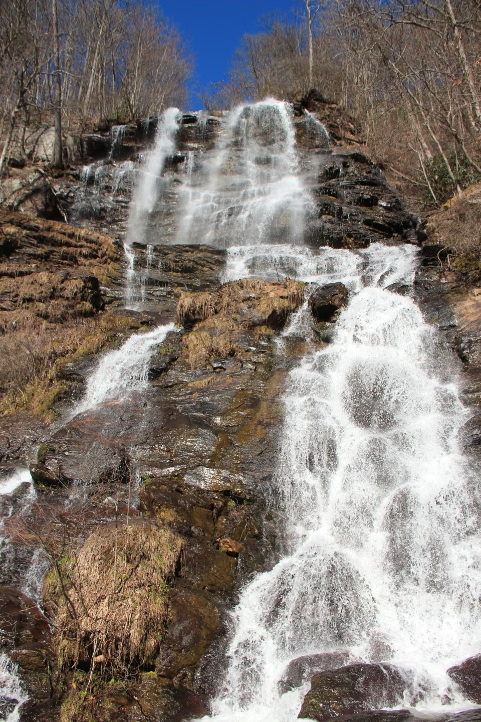
Northern Mountains · Amicalola Falls

Northward, the land gives water a new course.

Northern Georgia enters the Appalachian Mountains. Amicalola Falls cascades down rocky slopes, creating a landscape different from the southern marshlands.

The total drop listed in the state park guide is 729 feet, or approximately 222 meters. This is the total height of multiple cascades, rather than the vertical height of a single sheer cliff face.

Mountain trails, waterfalls, and scenic areas offer a different way to visit the northern townships. Accommodation, dining, and outdoor services need to be arranged considering the season, road conditions, and visitor stay time.

Amicalola Falls · Northern Georgia Mountains
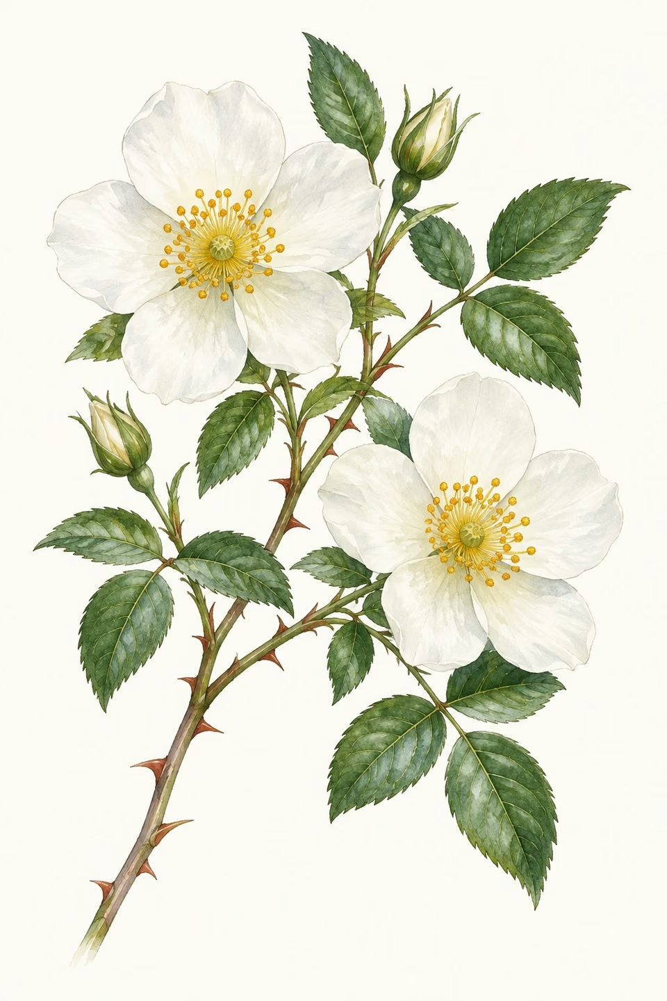
State flower · Cherokee rose

A white flower with a history worth distinguishing.

The Cherokee rose was selected as the state flower of Georgia in 1916 and is often referred to in English as the "Cherokee rose." It originated in Asia and is not an indigenous plant of Georgia; the state symbol and the plant's place of origin are two separate things.

Cherokee rose · State flower illustration

This page features floral illustrations in artistic style. From deep shade of trees to bustling ports, from community history to wetlands and forests, Georgia's beauty lies hidden in these very different lives.

Statewide work and business conditions

Global connections return to local work.

4.9857million nonfarm jobs

After seasonal adjustment in August 2026.

The Bureau of Labor Statistics release of September 18 reported 4,985,700 nonfarm jobs in Georgia for the month and an unemployment rate of 3.2%. These statewide figures provide context for the broader employment picture.

Logistics firms facing ports, professional services in urban areas, and accommodation businesses in mountain regions cater to different clients and schedules. When choosing a location, it should be compared with the actual service area, workforce, premises, and transportation conditions.

Industries & establishments · 2023

The work that keeps communities running.

Beyond aviation and ports, healthcare, retail, restaurants, manufacturing, and professional services also cater to residents' needs. The following annual establishments data further supplements the state's industry structure.

The state recorded 261,320 employer establishments and 4,405,730 paid employees. A single company may operate several stores, offices, or factories, so establishments are not a count of registered companies.

Health care & social assistance586,195 people

Retail trade513,434 people

Accommodation & food services475,652 people

Administrative & support services430,974 people

Manufacturing409,333 people

U.S. Census Bureau, 2023 County Business Patterns. The series primarily covers private, nonfarm establishments with paid employees. Employment is measured for the pay period that includes March 12. The 2023 release was the latest in this series available when checked; it is not a measure of current monthly employment.

Business Materials: Georgia Port Authority announcements on July 28 and September 15, 2026; Atlanta City Aviation Department 2025 fiscal year report; Bureau of Labor Statistics' state employment report on September 18, 2026. Fiscal years, natural months, and annual 'establishments' statistics are separately read.

STATE.REPORT

An editorial feature by STATE.REPORT. Image creators and licenses are credited below.

Sources & further reading

Population estimates ↗

U.S. Census Bureau: state population estimates for July 1, 2025.

Savannah's Historic Square

Savannah City Government: Started in 1733 with the Square and Public Greens.

Oglethorpe’s city plan

The Georgia Historical Society: Neighborhoods, Squares, and Urban Layouts.

Martin Luther King's Atlanta

National Park Service: A historical site on Auburn Avenue featuring community, church, and civil rights movement history.

Birth Home ↗

National Park Service: Martin Luther King Jr.'s childhood home and neighborhood.

Augusta Canal

National Park Service: Constructed in 1845, with power, water supply, and transportation facilities.

Canals and Urban Environments

Augusta Canal Authority: industrial history and the natural environment along the canal.

Cumberland Island’s maritime forest

National Park Service: Live oak forests, sea breezes, and coastal ecology.

Cumberland Island Salt Marsh

National Park Service: Tides, Plants, and Coastal Wetlands.

Okefenokee Swamp

US Fish and Wildlife Service: Peat Wetlands, Habitat, and Conservation.

Wetland Ecological Data

US Fish and Wildlife Service: Open waters, forests, and changes in hydrology.

Amicalola Falls

Georgia State Park Department: Northern Mountain Waterfalls and Park Environment.

Northern Mountain Trail ↗

Georgia Department of Natural Resources: Falls and Hiking Trails Information.

State Flower and Wildflowers

University of Georgia Extension: the Cherokee rose, its origins and its place among state symbols.

Image credits & licenses

Verify your email

We will email you a six-digit code to sign in.

By continuing, you agree to the Terms and acknowledge the Privacy Policy.

Search history

Your searches from the last 30 days. Viewing this list does not use searches. Full company reports are not saved here.