STATE.REPORT
A landscape of volcanoes and water

Oregon

A world of blue within a volcano.

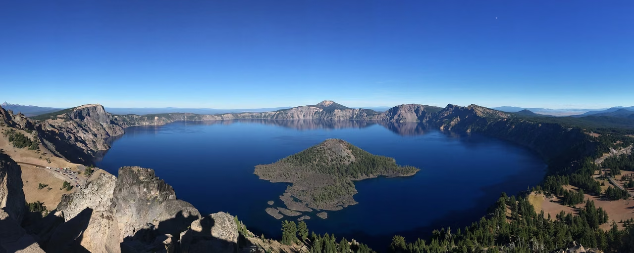
Crater Lake · The deep blue lake within Mount Mazama’s collapsed caldera
State capitalSalem
Population · 2025 estimate4,273,586 people

Snow falls on the lake. Rain moves through the forest. Water and stone shape the many faces of Oregon.

Water, chapter one · Held in the mountains

First a mountain. Then a lake.

About 7,700 years ago, the massive eruption of Mount Mazama left its central body to collapse inward, creating a large caldera. Today, the placid lake surface covers a space left over from a significant geological change.

Rain and snow gradually filled the basin. Wizard Island and other volcanic features formed through eruptions after the collapse. Lake, islands, and steep caldera walls record different stages in the history of this deep blue landscape.

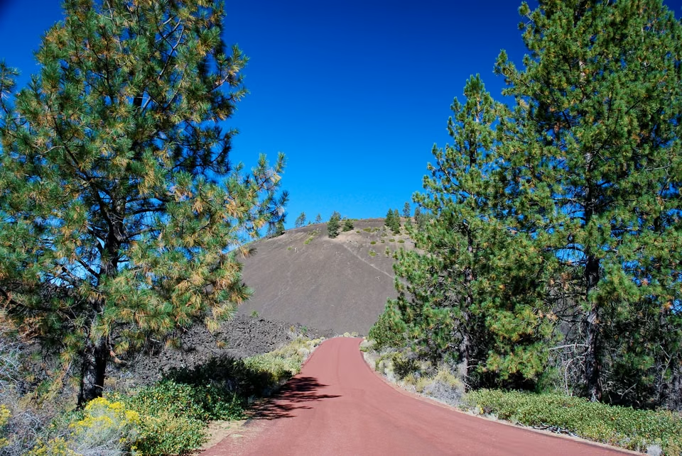
Newberry National Volcanic Monument · Lava Butte's volcanic landscape
Newberry - Another Chapter in Volcanic History

Lava leaves more than one signature.

Oregon's volcanic landscape is not limited to one deep lake. Newberry Volcano has erupted multiple times, leaving volcanic cones, various types of lava, and caldera landscapes. The formation times and processes at different locations cannot be summarized by a single eruption.

The rough lava surface, volcanic cones, and later vegetation leave geological traces on the ground. They echo Crater Lake, giving the southern midsection a distinct volcanic landscape.

Second Water Passing Through Rock Layers

Falling water.

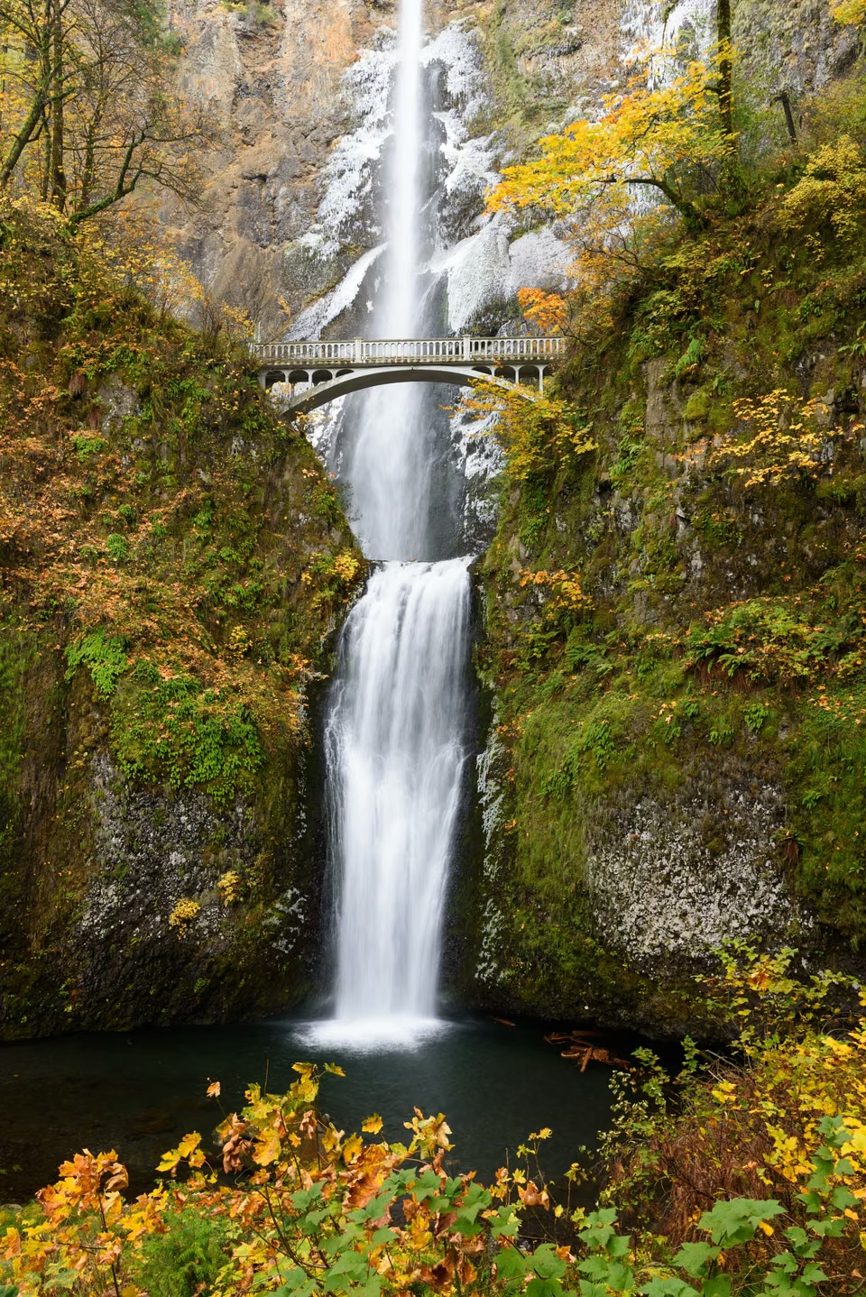
Multnomah Falls · Columbia River Gorge

Multnomah Falls · Water descending over basalt cliffs

Watch the water. Read the rock.

The rocks exposed on the canyon walls are part of the Columbia River Basalt Group. Water cascading down layered cliffs creates a direct view of the geological section.

Not only does the canyon have waterfalls. The rain shadow created by the Cascade Mountains causes western western coniferous forests to gradually transition to drier grasslands to the east. Vegetation in the same canyon varies based on its geographical location.

Thus forests, rivers, and rock walls are not isolated backdrops. Where the rain falls, how water flows, and how rock strata are exposed all determine the colors and shapes encountered along the way.

Third Water System · Enters City

A bridge joins two sides of daily life.

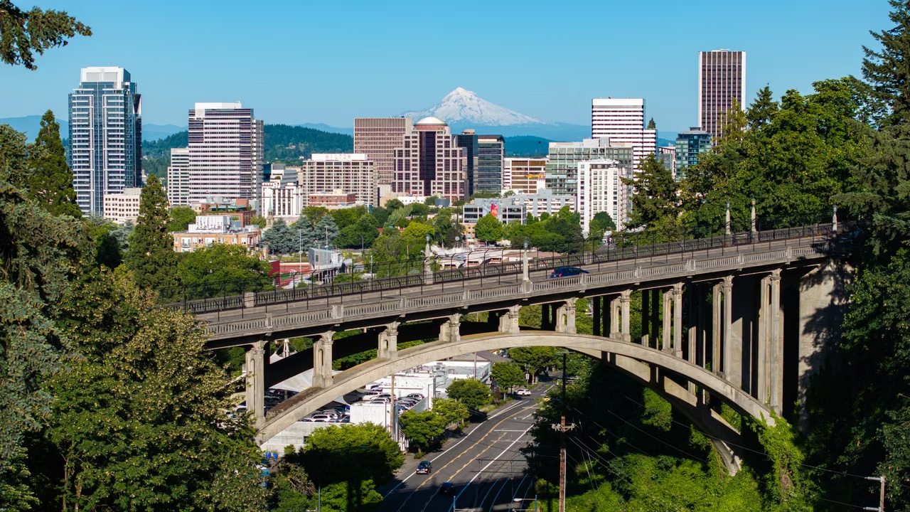
Portland · Willamette River

Portland from above · Photographed in 2024

A city’s connections, renewed each day.

Portland's bridges connect the banks of the Willamette River. Cars, public transit, bicycles, and pedestrians cross above, while vessels pass below. City life unfolds through movement in many directions.

Completed in 1910, the Hawthorne Bridge remains in use after decades of maintenance and alterations. It is both a historic structure and working urban infrastructure, with responsibilities beyond its familiar outline on the skyline.

Offices, neighborhood businesses, healthcare, and manufacturing are spread throughout the metropolitan area. Employee commutes, customer access, delivery routes, and available premises all affect how a business operates.

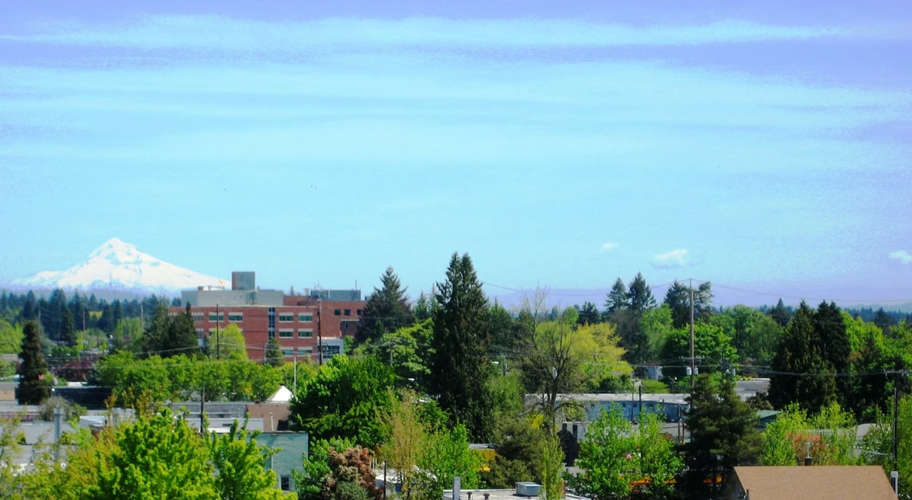
Hillsboro · City and manufacturing

The changing fortunes of the Silicon Forest.

Downtown Hillsboro with Mount Hood in the distance
2025 goods exports−17.3%

Change from 2024 Amount

The Oregon Department of Economic Development noted in its analysis released in 2026 that the total value of goods exported from the state decreased by approximately $5.8 billion in 2025. One of the important factors contributing to this decrease was the decline in exports of electrical mechanical products related to semiconductors.

Hillsboro's semiconductor and electronics industries depend on the surrounding workforce, suppliers and infrastructure. Research, production and equipment services each need different conditions; an industrial cluster does not mean every part grows at the same pace.

Changes in total exports of goods do not necessarily reflect changes among all companies. There is still growth in categories like fruits and nuts in 2025. When reading business reports, specific products, customer locations, and supply chain segments provide more explanatory power than looking at a single total for an entire state.

Export amounts are trade statistics and should not be equated with a company's profits or total output for the region. For a supplier, it is more worthwhile to verify the scope of business, progress of projects, payers, and actual delivery requirements.

Oregon Economic Development Department's "Oregon Trade 2025," February 23, 2026. Original trade data comes from the U.S. Census Bureau.

Crossing mountains

A river finds a new role.

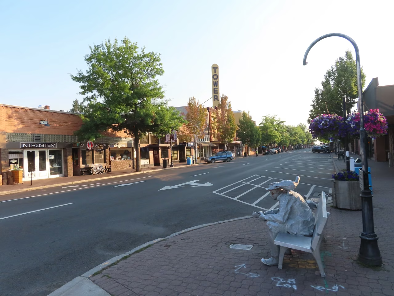
Bend · Central Oregon city with street landscapes

From timber transport to public waterfront

The Deschutes River is tied to Bend’s timber industry. The waterfront around the old mills later changed, as paths, parks and new uses became part of city life.

Connected walking routes now follow both banks through the Old Mill area, with park access for water activities. The river that once supported production also provides a place for residents’ everyday recreation.

Mountain communities need everyday services

Outdoor activities and tourism define Bend's identity, but residential, healthcare, dining, retail, and professional services also support the city. Short-term visitors and long-term residents use the same city but have different needs.

The surrounding volcanic landforms, mountains, and rivers make Bend a good place to observe the differences within Oregon. It is not the same kind of environment as the wet western forests and coastal towns.

Eastern Oregon · John Day1887

An old store, and lives that crossed the Pacific.

People left between mountains and valleys.

Small objects, far-reaching stories.

In the late nineteenth century, two Chinese partners from Guangdong bought a building for a grocery, an apothecary, and an import business. It later became a meeting place and mutual-support center for the local Chinese community. Commerce, medicine, and neighborhood life shared one roof.

Mining and railroading brought Chinese workers to the western United States. In an environment of exclusion and discrimination, a place for communication, assistance, and maintaining cultural life meant more than just trade.

Today, the site still retains a large number of historical objects, medicines, packaging, and shelving units that document daily life. These items make the historical story of the eastern part of the state more than just tales of mountains and resources, but also include stories of migration, livelihood, and community building.

Set John Day alongside Portland and Bend, and Oregon’s cultural landscape becomes richer. Places of different sizes preserve different memories; even a modest shop can hold an important chapter of local history.

Fourth Kind of Water: Reaches Coast

At low tide, the shore is full of life.

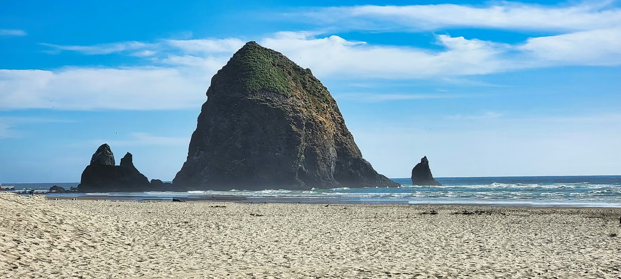
Cannon Beach · Haystack Rock and nearby sea stacks
Above Rock

Seabird nesting season

Haystack Rock provides seabird nesting habitat. Tufted puffins are among the birds studied here, with long-term observations tracking breeding and population changes.

Seabirds forage in the sea and need suitable land for breeding. Rocks are not isolated in the water but are closely connected to the surrounding marine environment.

Under Rocks

A glimpse of the intertidal world

The pools and damp rock faces become visible at low tide, and sea anemones, mollusks, and other creatures live between immersion and exposure. Seeing them does not mean that this place exists only at low tide.

Understanding the coastline involves accounting for tidal changes. From afar, it's a conspicuous landmark, but upon closer inspection, one sees that different heights accommodate various forms of life.

Yellow in the shade.

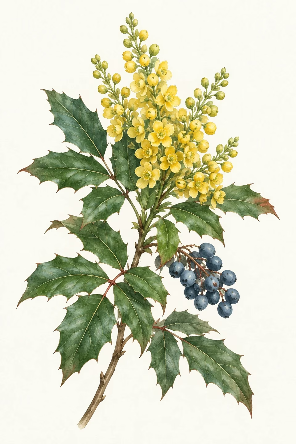
Grape by name, a different plant by nature.

Oregon grape is a plant species of Mahonia, and in 1899 it became the state flower. Its yellow flower clusters and spiky evergreen leaves easily distinguish it from true grape vines.

From the blue of the volcanic mouth to the greens and yellows of the woods, Oregon's colors come from different environments. Local plants bring the story of the grand landscapes back to a close-up view of each leaf.

Oregon grape · State flower illustration
The city is still operational.

Between nature and technology, everyday work.

Industries & establishments · 2023

The work that keeps communities running.

Beyond semiconductor, ports, and tourism, healthcare, retail, food services, manufacturing, and professional services connect residents' lives to urban operations. The image of industries in different cities cannot replace the complete employment structure of the region.

The state recorded 122,451 employer establishments and 1,697,911 paid employees. A single company may operate several stores, offices, or factories, so establishments are not a count of registered companies.

Health care & social assistance286,220 people

Retail trade214,932 people

Accommodation & food services188,725 people

Manufacturing175,491 people

Construction115,773 people

U.S. Census Bureau, 2023 County Business Patterns. The series primarily covers private, nonfarm establishments with paid employees. Employment is measured for the pay period that includes March 12. The 2023 release was the latest in this series available when checked; it is not a measure of current monthly employment.

STATE.REPORT

An editorial feature by STATE.REPORT. Image creators and licenses are credited below.

Sources & further reading

Population estimates ↗

U.S. Census Bureau: state population estimates for July 1, 2025.

Crater Lake's formation.

National Park Service: Mount Mazama's collapse, the filling of the lake, and its ecology.

The eruption history of Mount Newberry.

US Geological Survey: Lava, volcanic cones, and different stages of eruptions.

The rock layers at Multnomah Falls

US Geological Survey: Columbia River Basalt Group.

Columbia River Gorge

US Forest Service: Mountain rain shadow and vegetation differences at canyon ends.

Haystack Rock's puffins

U.S. Fish and Wildlife Service: Long-term monitoring of tufted puffins.

The bridge over the Willamette River.

Multnomah County: bridges, transport and connections between the city’s riverbanks.

The Hawthorne Bridge's history

Multnomah County: A city bridge built in 1910.

Bend's River Trail

Bend Park and Recreation Areas: Public Spaces along the Deschutes River.

Oregon State Symbol

Oregon State Archives, Oregon Blue Book: the state flower and other state symbols.

Crater Lake's newts

National Park Service: The Impact of Local Amphibians and Invasive Species.

The Chinese heritage site in John Day

Oregon State Parks Department: History of Grocery Stores, Pharmacies, and the Chinese Community

The history of an old store.

Oregon Historical Society: Chinese immigrant life and historical records in John Day.

Image credits & licenses

Above Crater Lake (cropped).jpg · Athleticamps derivative work: User:Maps and stuff (cropped to 2.5:1 ratio, eliminating sign and stone structure on right while centering on lake; increased brightness in dark areas; saved as a high quality JPG) · CC BY-SA 4.0。

Portland Oregon Aerial, June 2024.jpg · Spicypepper999 · CC0。

HillsboroDowntownMtHood.JPG · M.O. Stevens at en.wikipedia · Public domain。

20210803 03 Bend, Oregon.jpg · David Wilson · CC BY 2.0。

Haystacks Rocks and the Needles,Cannon Beach.jpg · John Manard · CC BY-SA 2.0。

Multnomah Falls October 2019 stack.jpg · King of Hearts · CC BY-SA 4.0。

Lava Butte, National Newberry Volcanic Monument - DPLA - 09ec2c436bf4721d0e0a1034ce8069cd.jpg · Gary Halvorson, Oregon State Archives · CC BY 4.0。

Verify your email

We will email you a six-digit code to sign in.

By continuing, you agree to the Terms and acknowledge the Privacy Policy.

Search history

Your searches from the last 30 days. Viewing this list does not use searches. Full company reports are not saved here.